Renting a Scooter, and Let's Scooting around Chumphon!
From last episode: โฮมสเตย์กลางใจป่า บ้านในวง ละอุ่น ระนอง หมู่บ้านในวงล้องของขุนเขา
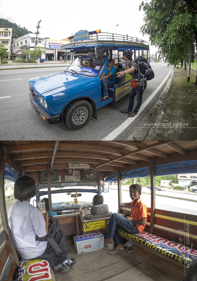
After luckily getting on the car of one of the generous locals of Ban Nai Wong, La On, Ranong Province who is dropping off durian at Kok Pip Market, Thung Tako District, Chumphon Province.
We both also got dropped off at the van station of Chumphon. Then we both get on the van for 160 THB each and heading towards downtown of Chumphon.
We are backpacking and find the closest hotel to our dropping off place and it is Nanaburi Hotel. It is 700 THB per night and we book for two nights.
And this is a new morning in the downtown Chumphon. It is the mid of July during rainy season but the sky is bright. Amazingly stop raining for sometimes in welcoming us!
As for Ban Nai Wong, after we left yesterday afternoon, the rain was falling incredibly hard.
What incredibly is not that it rained but that it wasn't raining the whole time while we were there!
The first mission of today is ..... eating!
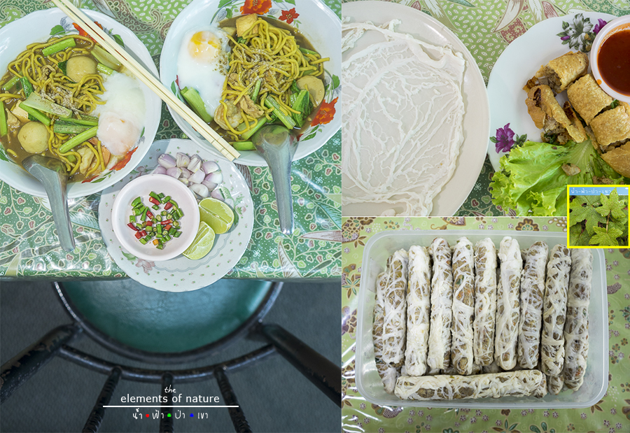
Let's find something to eat first,we find Chumphon Tae Tiam restaurant, the one that is closed to our hotel.

Chumphon Tae Tiam: N10° 29.994' E99° 10.649'
Delicious!
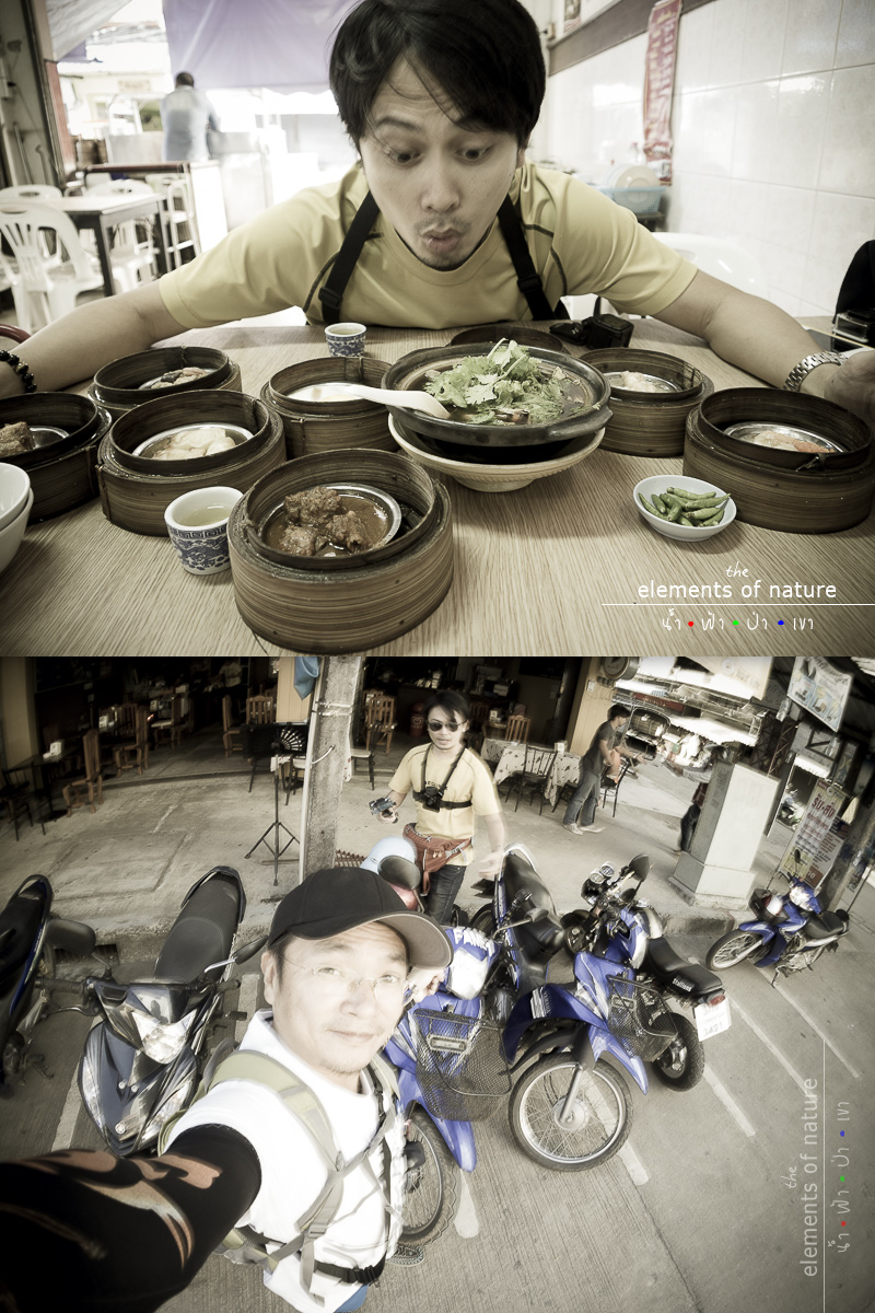
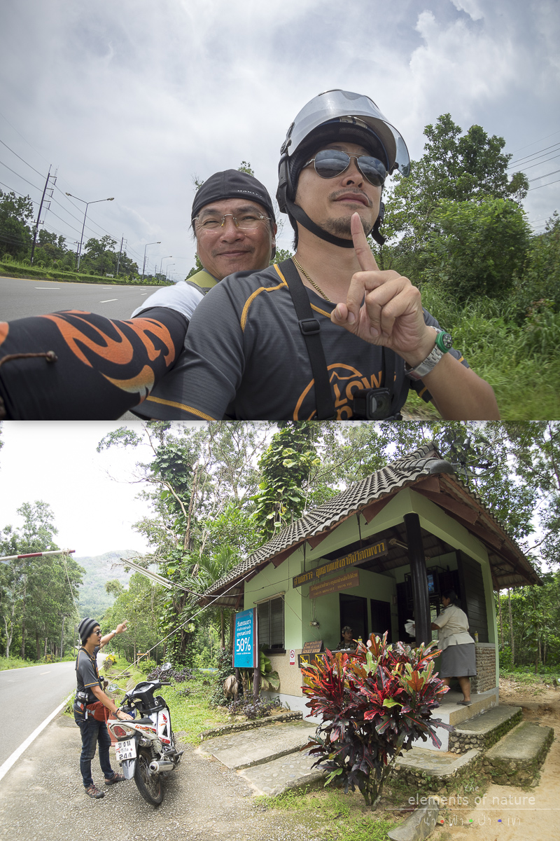
Stomach is full and it's time to start journey. Our main vehicle for this trip is a rental scooter. I have asked around yesterday and found that there's one rental shop near our hotel.
Fame Tour Car Rental Shop: N10° 30.002' E99° 10.617'
We've got our rental scooter now. There are two available models of scooters, the hired price starting from 150-300 THB per day depending on the scooter and its conditions.
Fame Tour also offers other services such as vans, trucks, guesthouse, and restaurant at the front of the shop and many foreigners are sitting there.
In addition, they also offer the airport pickup from Chumphon, for more details, please click Fame Tour .
Okay now, our scooter is ready, put on our helmet, smelling the scent of the sea and let's not wait anymore, let's go!!!
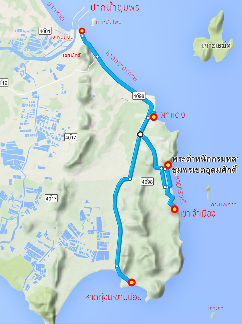
Only approximately 7 kilometers and we now arrive at our first beach at Pak Had (mouth of the beach). This is the recommendation from our local photographer who is a friend of my co-trip friend.


Advertisement
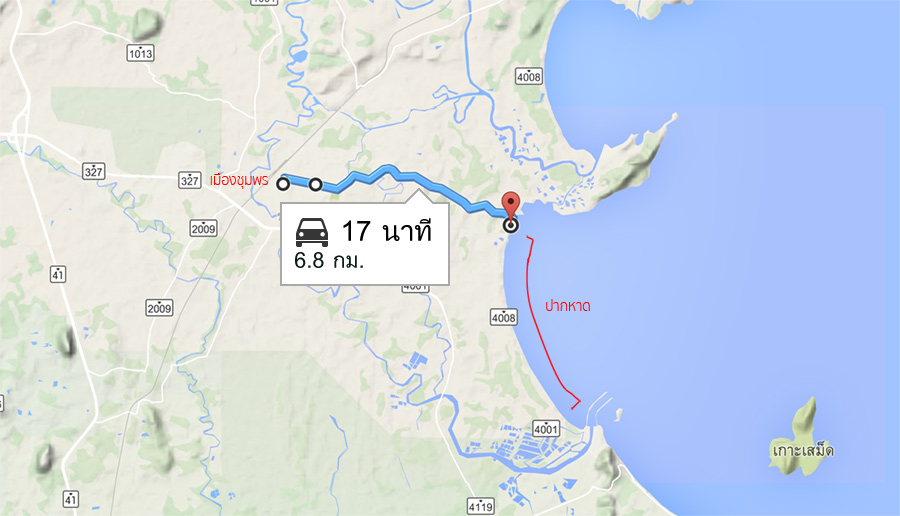
Ban Pak Had: N10° 29.455' E99° 13.756'
We come to this beach as our first destination because our local friend said that now the water is lowering! And at this Ban Pak Had Beach, there's many beautiful shooting angles, particular when the water is in low tide.
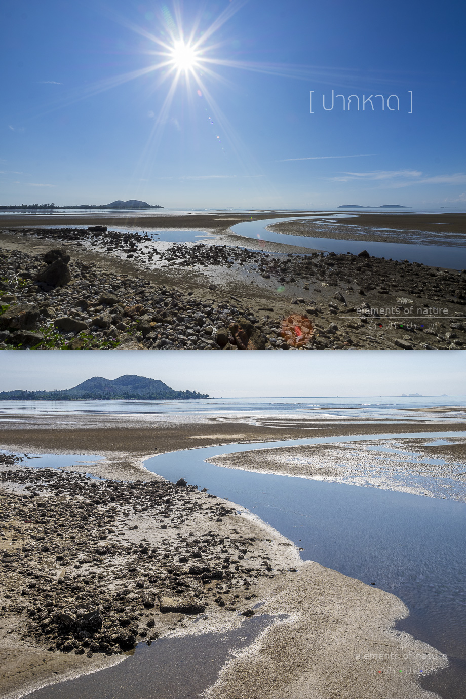
What do you think? Is it beautiful? I think it's quite beautiful but we come here a bit late so the sun is far up in the sky. If we were coming earlier, I think we would have gotten much more beautiful photos.
The sky is so overwhelming open, I just want to scream!
Advertisement
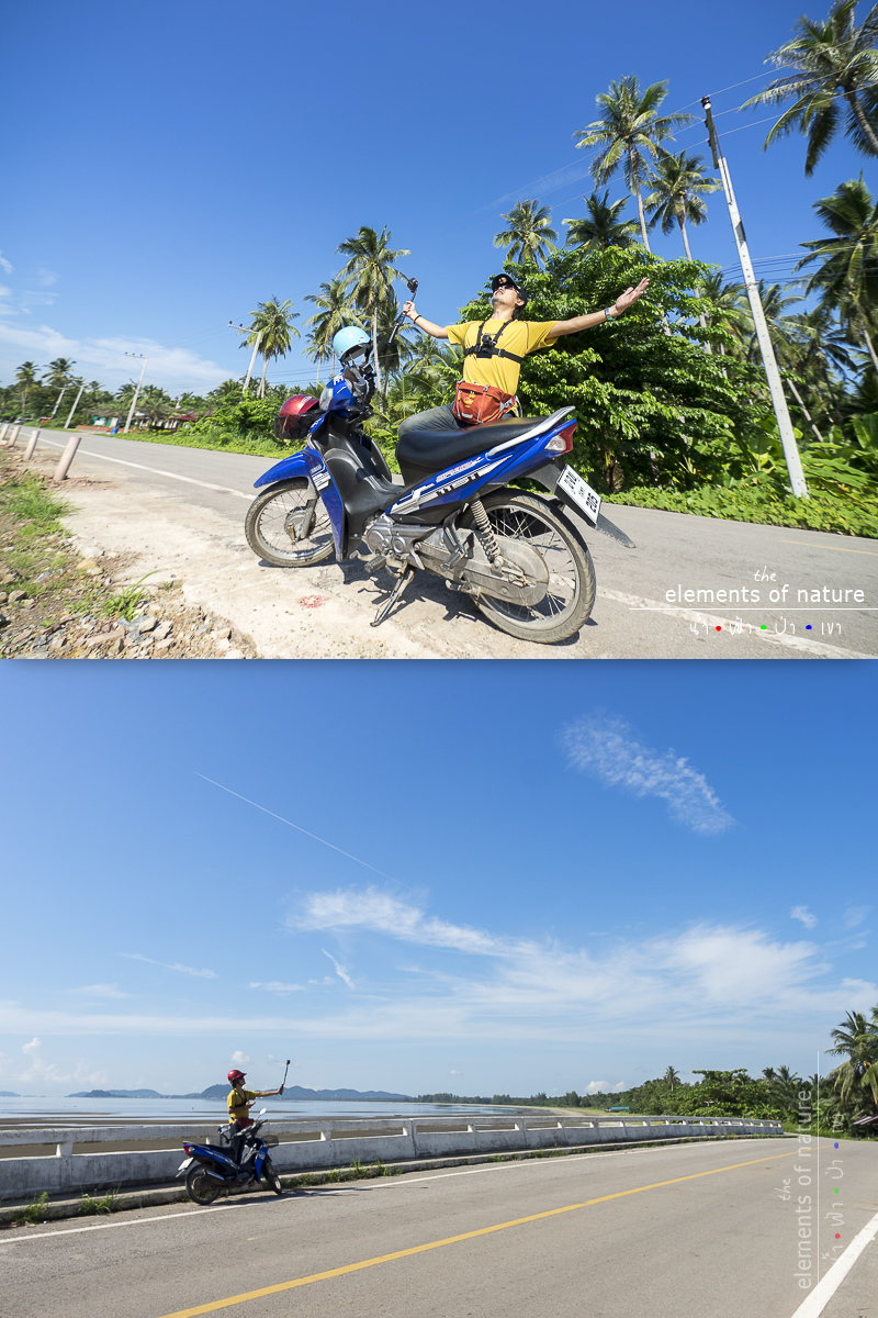
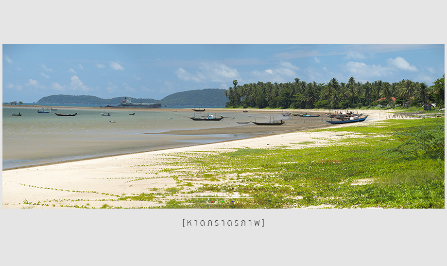
Scooting around and stopped at wherever we think it's beautiful, one stop after the other, no hurry, we have the whole day. Pak Had is an approximately 6 kilometers beach with 4 additional kilometers on the side road.
It is situated north to Pak Num Chumphon (the Gulf of Chumphon). From the below photo, to the left is Laem Hua Mong-Kho Kwang, and to the right, we will see Samed Island, the biggest island around this sea.
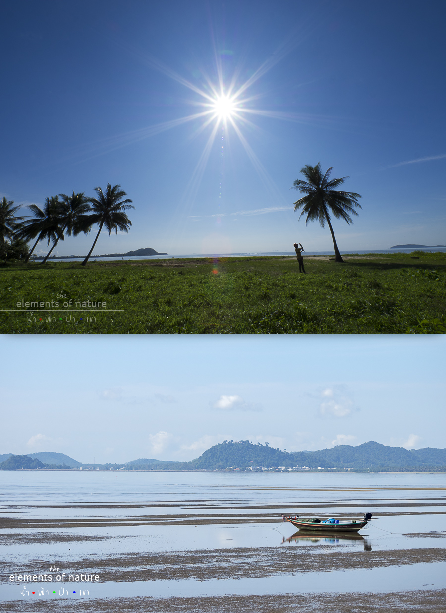
A small boat is sitting still at Pak Had Beach.
With our small scooter, we keep riding and stopping. The road is further away from the beach and then there's a sign leading to Ban Hua Thanon and I'm more than interested in this place, so there it is, our next destination.
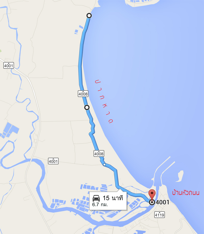
Ban Hua Thanon Community: N10° 26.528' E99° 14.672'
This is a fairly large community in Chumphon. Both sides are densely packed with houses. There are boats going back and forth to the other side, fisherman boat heading and coming back from the sea, quite a lively community.
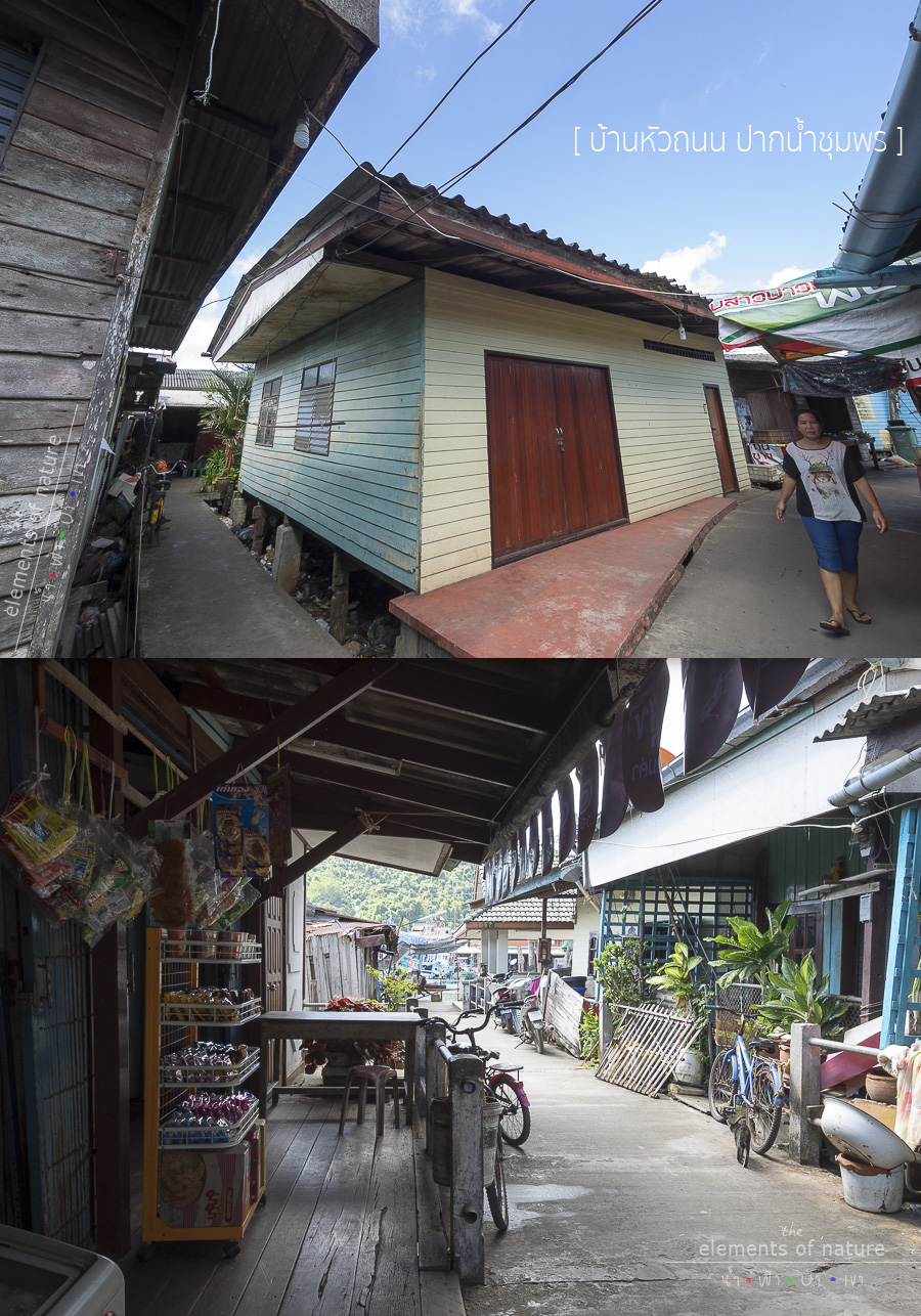
Looking from the map, the red spot is the end of our walk. We park our scooter at the police station, then walk across the bridge into the alley to the end of the road.
From the map, it shows that where we are is the island called the Fourth Island after talking to locals. This means that it also must have the First, the Second, and the Third Island.
The front river is Thataphao River. From the map, we will also see the sea route leading out to Koh Tao. The opposite side is the Municipality of Chumphon.
And what we see from the bottom right of the map is Mutsea Mountain, the Mutsea Mountain Viewpoint is at the far bottom right as well.
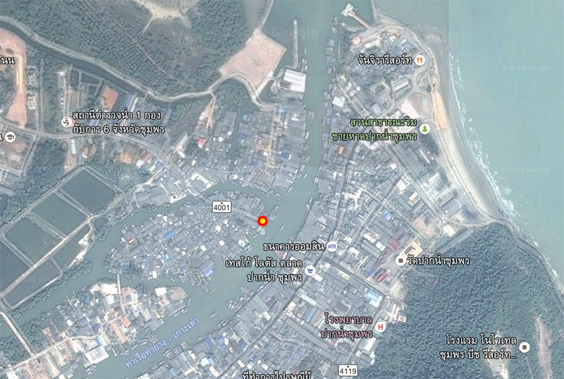
This is the end of the Fourth Island view at Ban Hua Thanon community as shown as the red spot from the above map. Here is also a boat station for getting across to the other side. Opposite side is the Municipality of Pak Num Chumphon with the Mutsea Mountain as the background.
Advertisement
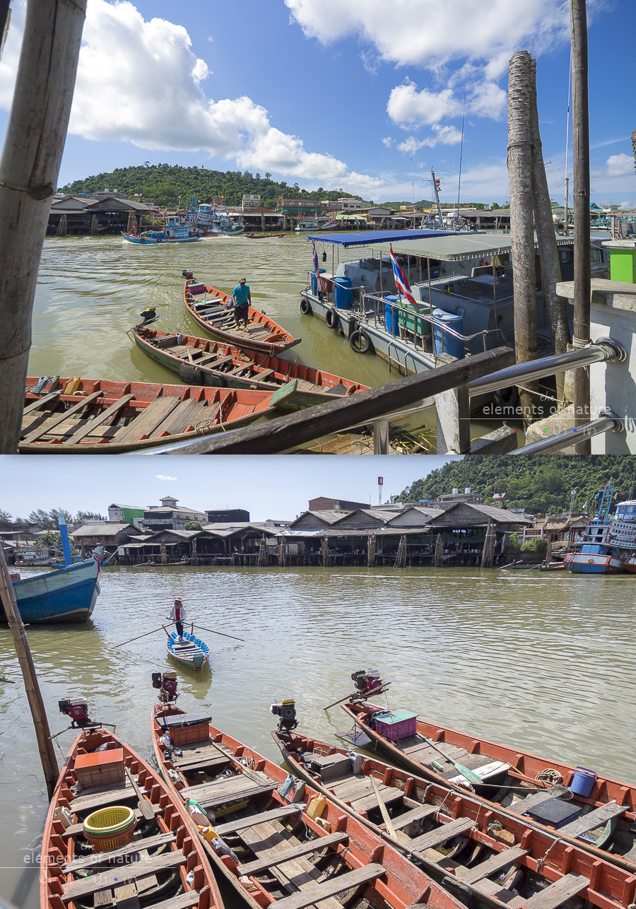
Upon walking out of Ban Hua Thanon, we are afraid whether or not we will get the ticket from the police as we simply tucked it beside the police booth, and we are lucky to find that it's still safely parked with no ticket
From the map below, we will see how indirect for us to have to scooting to our next destination in which otherwise just take a boat and we will be there......at Pak Num Chumphon (the Gulf of Chumphon).

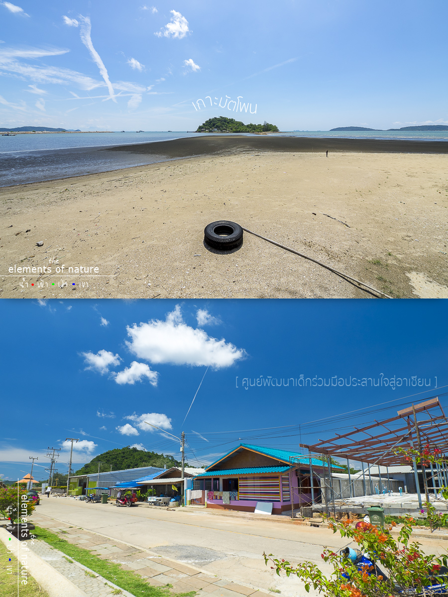
Pak Num Chumphon (The Gulf of Chumphon): N10° 26.720' E99° 14.969'
Back to the beach again, the water is getting up. Koh Mattaphon is a small island that we can walk to when the sea in front of us now is lowering to become Thele Waek or the separated sea and the sand will be appearing.
To the left we will see the dam line for sea routing of Tha Thapao River and the sea, and what's in the front of us now! Of course, it's the car tire!!! hehe
Let's turn back to the sea and face the road, we hear small kids' voices chatting from the blue house. My co-trip friend and me decide to visit and talk to students in this school.
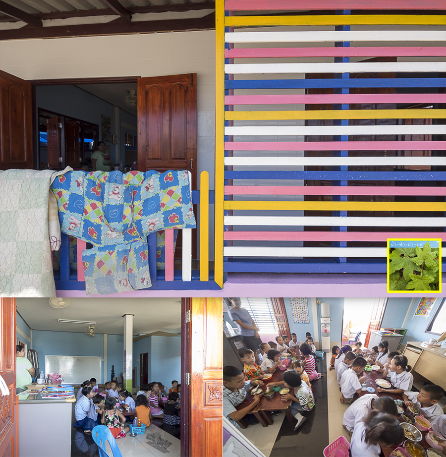
This place is called Children Development and Cooperation for ASEAN Center 10.445185, 99.249540. Most of students are Burmese and their parents are fishermen. There's only once classroom with a different age of students, about 5-6 grades difference.
In the classroom, there's only one teacher and a assistance who concentrate and teach each student according to their age, so remarkable!! The teacher also invites our reader friends and the travelers who plan to travel here to donate study suppliers, students uniforms, notebooks, pencils, and rulers, the staff will be more than happy to receive your donation.
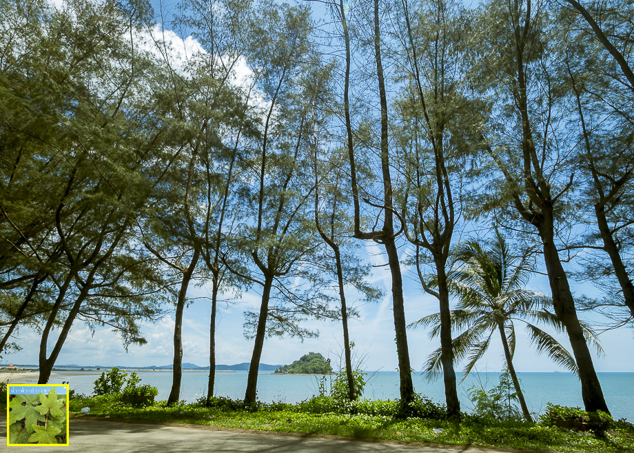
Let's continue on scooting, go along the beach, leaving the Gulf of Chumphon behind and going on the Mattaphon Mountain on the sea side.The road is a bit sloppy to the hill. The sea view behind pine trees is so beautiful!
We can see the sea on a higher angle and Mattaphon Island once more from this angle.
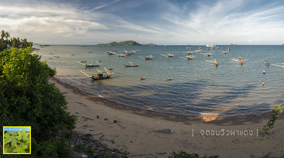
Then, we are just scooting around.... going pass Paradonpab Beach, Pha Daeng, Khao Pratumnak, Sairee Beach, Khao Phra Yuen, and Thung Makham Noi Beach.
Paradonpab Beach: 10.434154, 99.257428
Paradonpab Beach is a big beach, from the sight, it is approximately 2 kilometers long. Koh Samed is also about 2 kilometers away. It's looking quite beautiful, a lot of coconut trees.
Now, the sun is very strong so we park our scooter underneath the shadow of trees at the park located at the central beach.
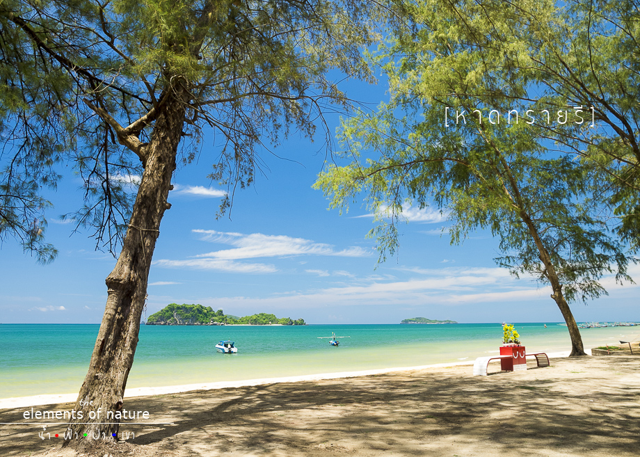
Sairee Beach: 10.394410, 99.280519
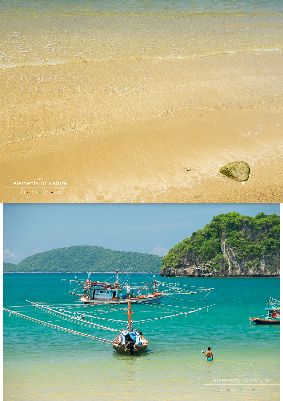
Probably, this is the most famous beach of Chumphon Province, very beautiful. A small island that is equipped with so many beautiful things, the most invisible one stand right in front of the Sairee Beach is Coconut Island.
On this beach, speed boat tour packing is also available. They will take us to tour the islands around and snorkeling and you can just get on the boat from this beach.
There's also this chic sign "Lae Had Sai Ree @ Chumphon" for us to check in online.

Only if the sun will not be so hot like today, it will be the happiest time that we can sit and listen to the wave hitting the sand.
It's time for lunch now at Sairee Beach. There's a lot of restaurants standing along the beach.
The shop we sit in is quite affordable, the crab is very fresh.
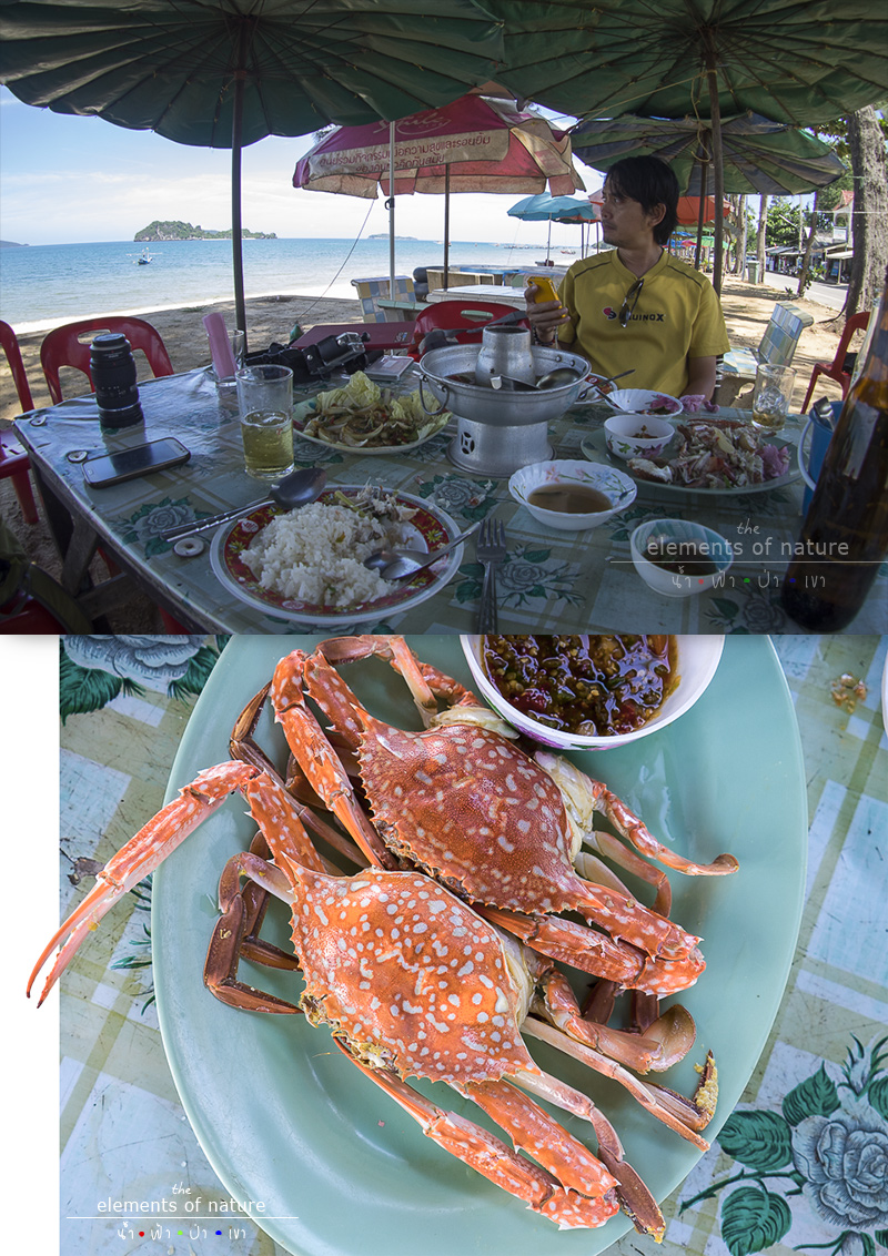
This is our menu and the price >>
spoil คลิก
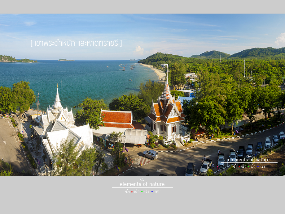
And we are still wandering around the Sairee Beach after having a good time with the seafood. We ride back to Khao Phra Tamnuk curve and enjoy the coffee at this cafe which is located opposite to the entrance of the Battleship Memorial and Krom Luang Court.
SaiRee Coffee
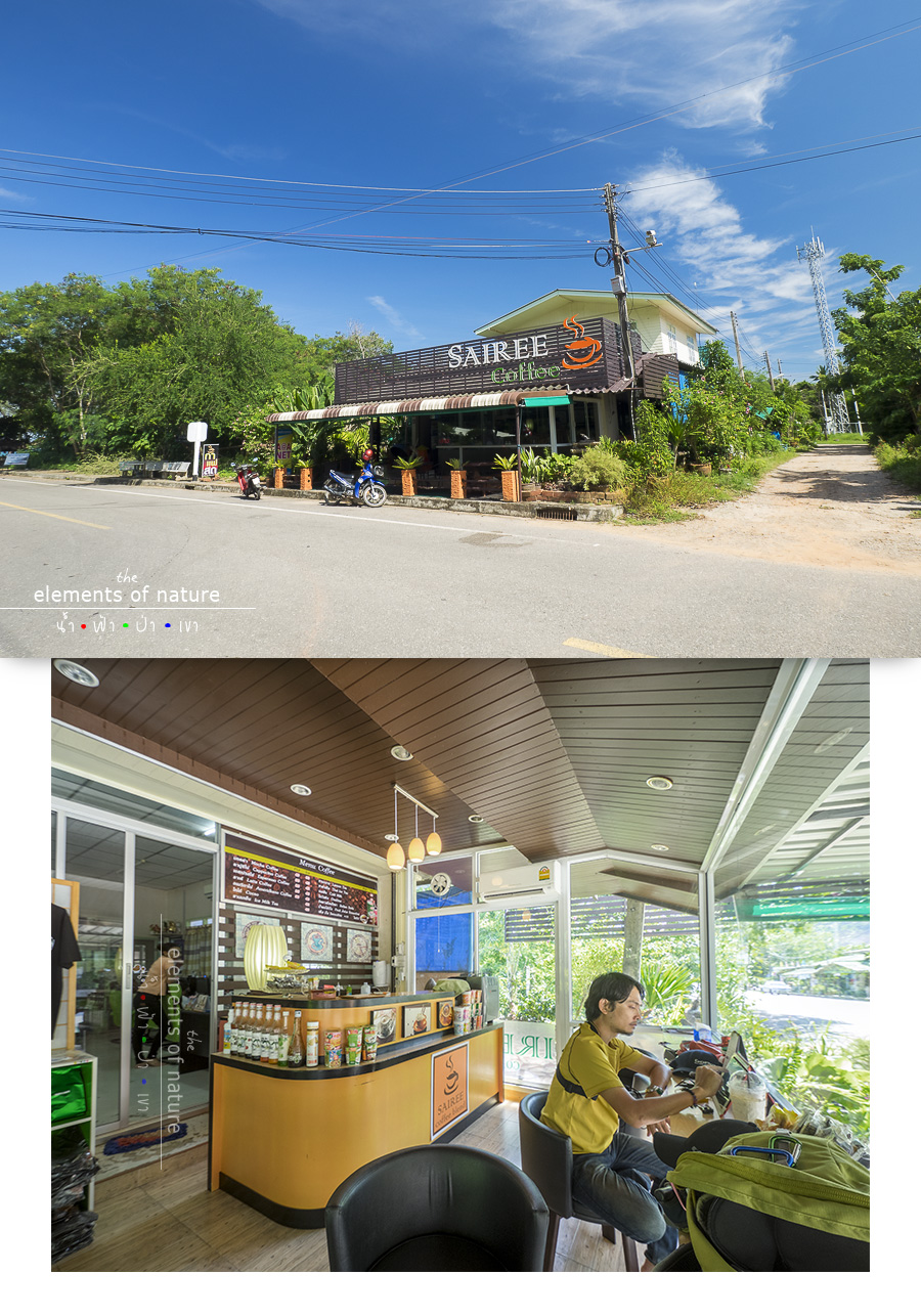
Seeing this icy cool air, I almost want to sit back and sleep for an hour.
After that, my co-trip friend "Noom, Photo", a network man, has a Facebook friend at Chumphon. So then they talk together and send in a friend.
He comes to meet us at this cafe. He comes in with his truck unplanned and ask where we want to go.After talking for a while, he said just scooting around him and he will take us to a good angle for photography.
Before we actually realized that this is a friend of our friend who come to us and take us touring around, haha.
We already scoot followed him. And then he takes us here.
Khao Chao Muang Viewpoint
N10° 23.063' E99° 16.917'
It is about 100 meters height mountain. Khao Chao Muang is situated at the end of Sairee Beach, it has a dominant Black Walking Buddha Statue facing to the sea.
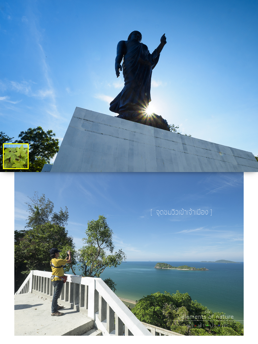
We can see a beautiful view of Chumphon Sea from this Khao Chao Muang Viewpoint.
In a while, Khun Tonruk, another professional photographer of Chumphon, Khun Num's friend is also coming to see us after sending a friend to welcome us first.
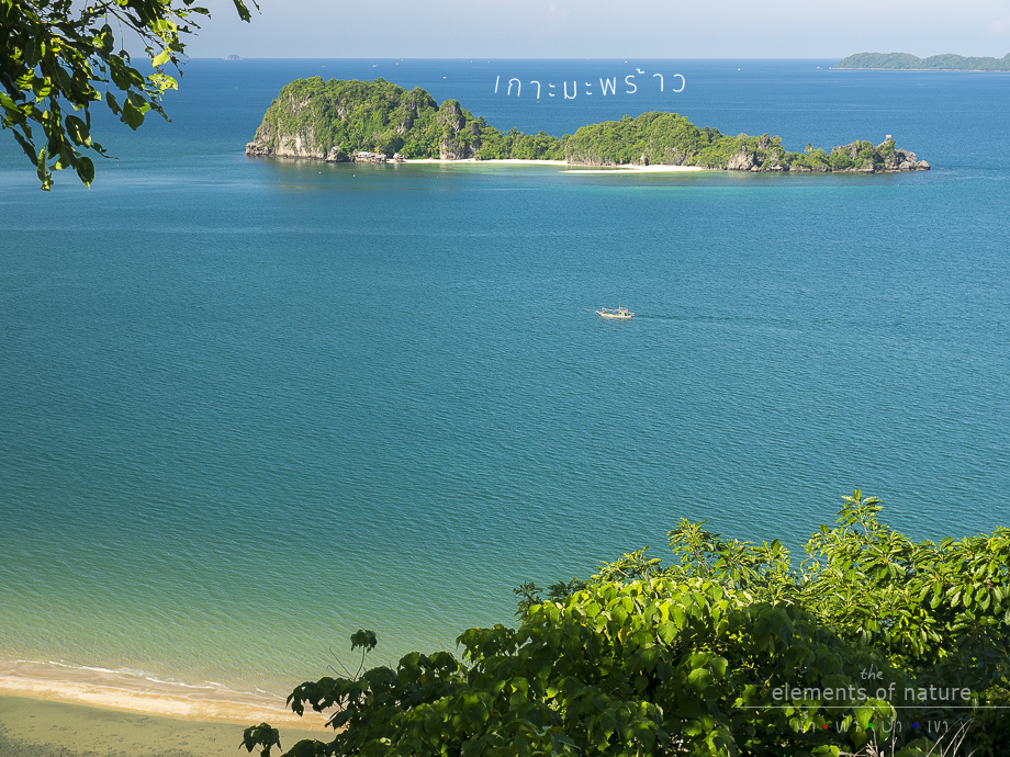
And then the locals take us to another place for photography. We scoot after them to go back to Khao Phra Tamnuk to see the high angle of Sairee Beach in a panorama view.
Looking back from here, we can also see Khao Chao Muang that we just got down.
Khao Phra Tamnuk Viewpoint
N10° 24.002' E99° 16.770'
We decide to leave our rental scooter at Phra Tamnuk and get on a truck with them.
This is a second stop that the two local photographers take us to drive back and right before reaching Paradonpab Beach, we turn into a sloppy road and meet another viewpoint.
Pha Daeng Viewpoint
N10° 24.973' E99° 16.503'
And then they take us far away to the South and get to another beach, which is a pier to Koh Tao called Lomprayah High Speed Ferries Pier.
Let's come to enjoy another small beach on this small bay.
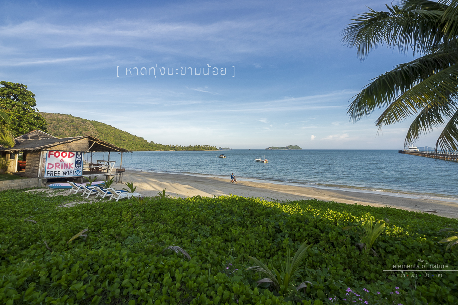
Thung Makham Noi Beach
N10° 21.496' E99° 15.923'
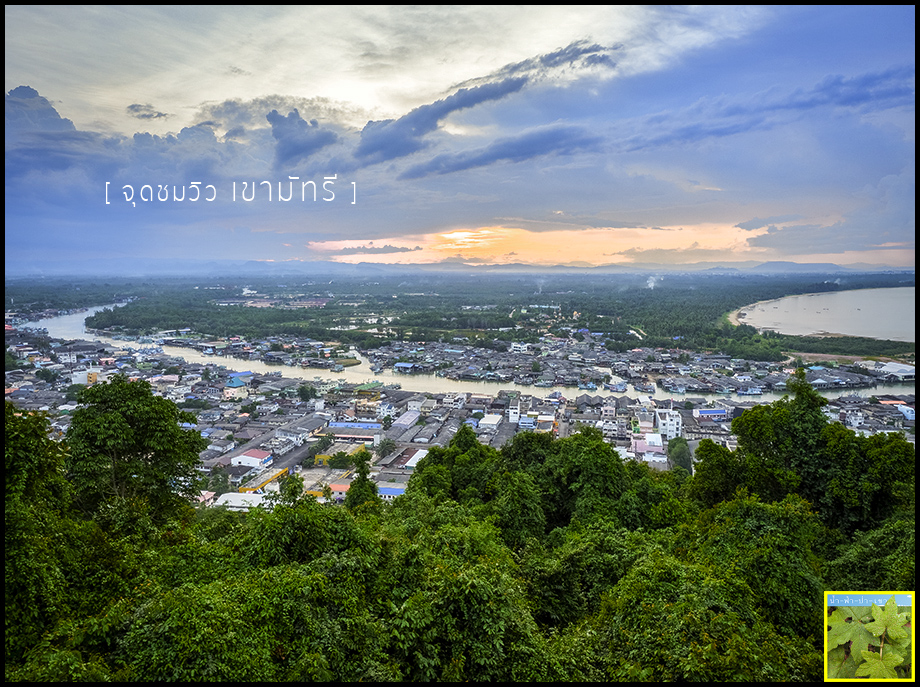
Finally, they both take us to wait for the last light of the day and to enjoy this twilight view at the most famous viewpoint of Chumphon.
Mustsee Viewpoint
N10° 26.285' E99° 15.082'
This place is approximately 110 meters above mid sea level.
Since we arrive here is already late evening, almost not in time for the last light, so we just find the place and settling down for photography and didn't have time to survey around or viewing from the other side.

Taking the last light of the day from this side, we don't need the tripod stand as we can just place our camera on the bar.
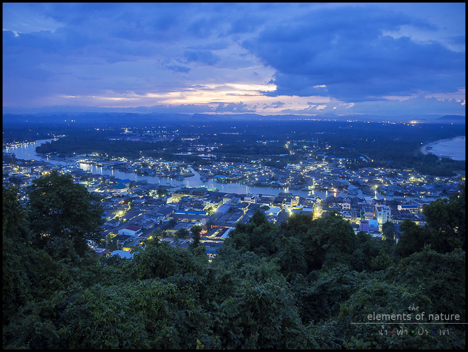
This view opens towards the sun to the Gulf of Chumphon, we can see the curve of the Gulf on the right, the Municipal of Chumphon at front with Thataphao River at the middle and the Ban Hua Thanon community on the opposite.
The Last Light at Mustsee Mountain
Stars on Earth, the Light from the City start to Illuminate
It's dark now, where do we sleep? Of course, we will scoot back to the hotel. Soon after, we get down from Mustsee Mountain and going back to take our scooter before scooting through the cool weather and back to our hotel.
Finishing taking shower and we go out to see our friends as appointed earlier at Farida Restaurant on Krom Luang Road, it is close to our hotel and it is the eating area.
I want to record here at this line that Chumphon has a lot of street food, probably the most in Thailand.
The new morning, it's time to say farewell to Chumphon and go back to Ranong as we booked our round trip ticket from there.
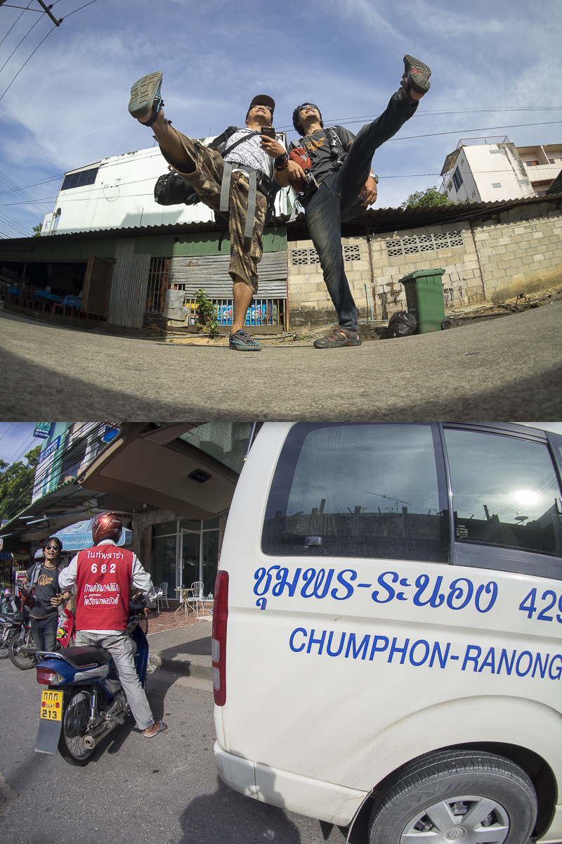
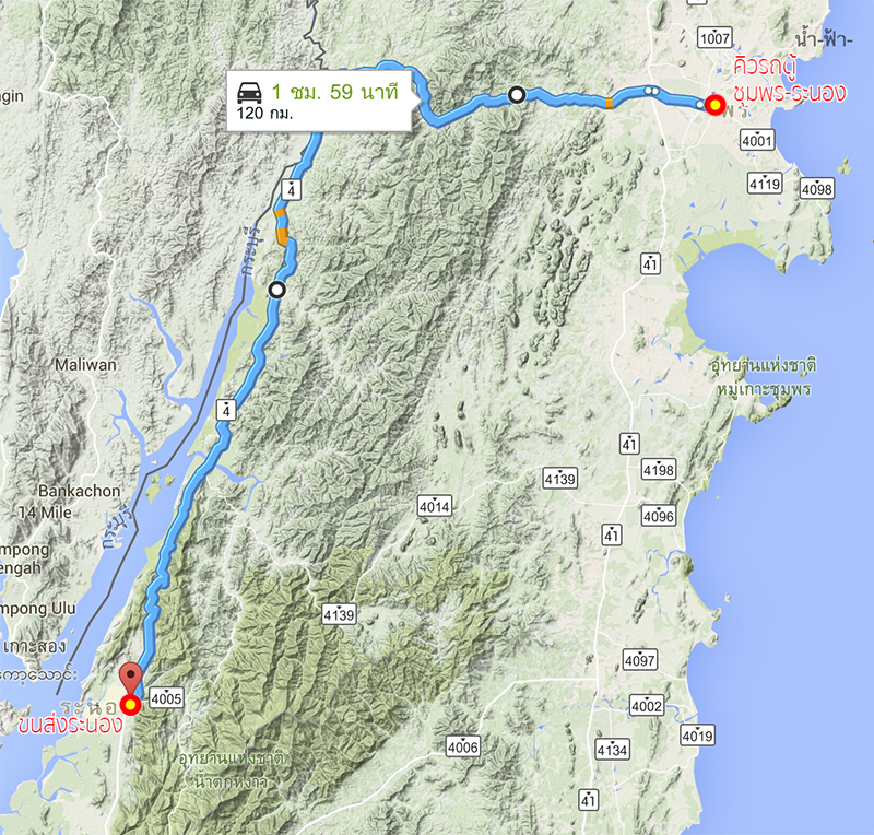
Then we go to the van station of Chumphon-Ranong, the fee is 240 THB per person.
The distance from Chumphon to Ranong is 120 kilometers which takes about 2 hours. We will be crossing Tenasserim Hills into the Andaman side.
Now, we arrive at Ranong Bus Terminal, we got off from the van here.
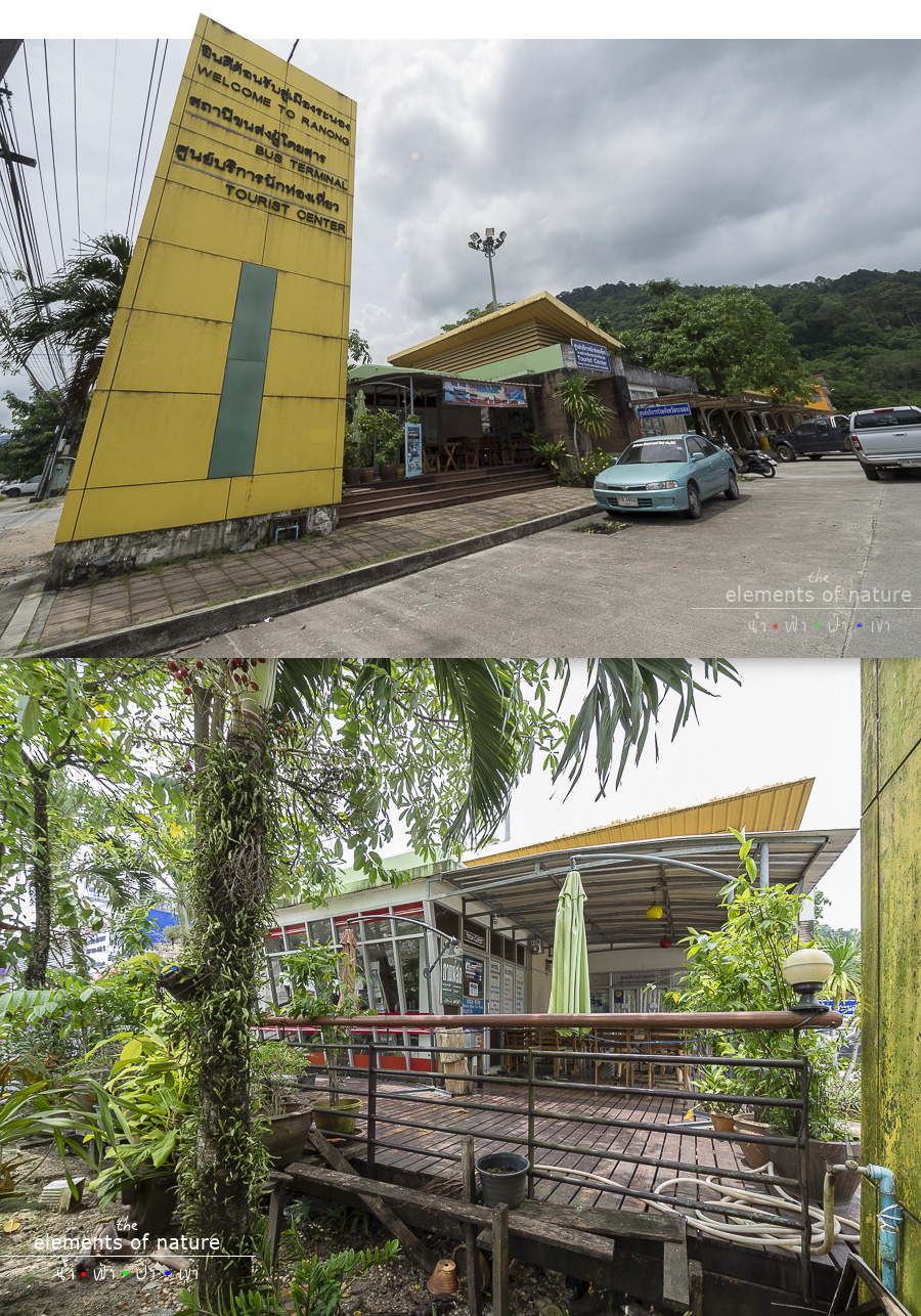
We enjoy our time in this shop, at first we thought it's the tourist center of the Tourism Authority of Thailand (TAT) by looking at the sign, and then we realized that that center has been moving to the other place and this place has become coffee shop and the booth to sell tour packages of a company.
Now, Fresh Coffee is selling the package tour to Kok Kom Island in Myanmar, the current famous island that has a heart shape sea.
Then we sit and chitchat about our trip to the owner and the owner is so kind to lend us scooter to travel in Ranong before our flight time in the evening.
So, let's go!!! Let's go enjoy Ngao Waterfall together, it's approximately 10 kilometers out of town.
Ngao Waterfall
N9° 51.286' E98° 37.868'
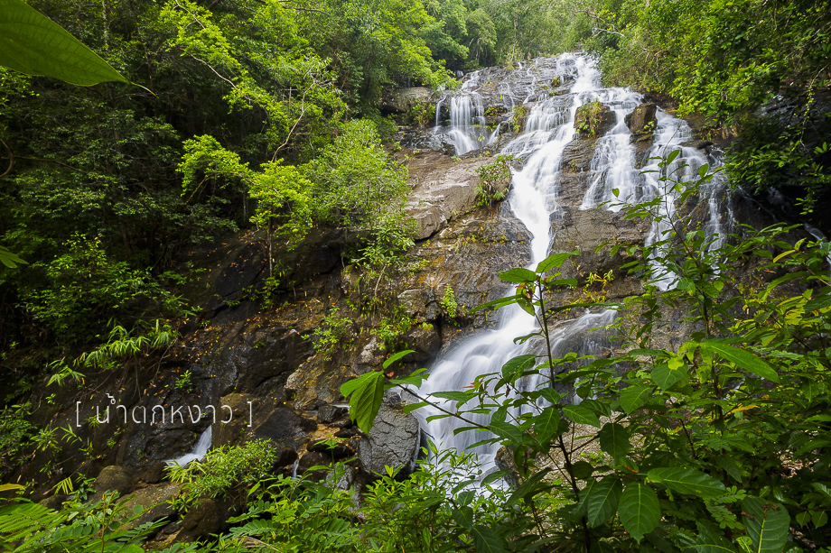
Ngao Waterfall is looking really grand from the outside on the main road. It looks gigantic and directly flowing from the top of the mountain. However, when we get closer, we can only see part of it.
Ngao Waterfall from the Outside Angle
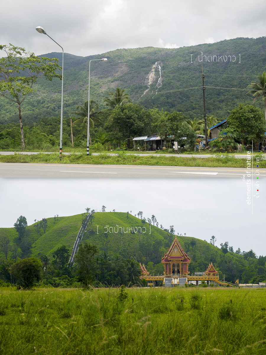
There's also this Ban Ngao Temple at the opposite of the entrance to the waterfall.
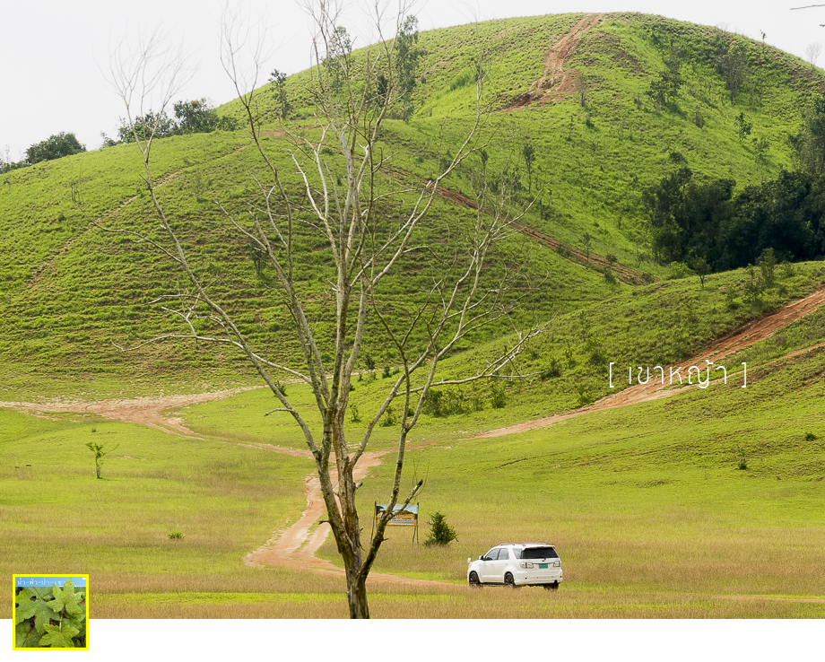
And a must not missed place is here....
Phu Khao Ya
N9° 51.896' E98° 37.032'
One of the unseen tourist places in Thailand.
After return a scooter with full fuel and thank you the owner for the great hospitality, we then take a Song Taew (taxi).
Khun Num then have appointed with another Ranong local Facebook friend here at this restaurant so that we can take some rest and shower.
Green House Restaurant: N9° 57.914' E98° 38.582'
It is located next to Ranong Hospital. It is the Chinese restaurant, I'm not quite sure whether it's Hokkien or Cantonese food.
Pee Phin, the owner is warmly welcoming us and invite us to try their highlighted menu.
On the left is to solve our hunger, Hokkien Noodle (may be, I forgot), but on the right, I will never forget.
Because the owner is so proudly to present, he said it is...
Fried Chun Spring Roll, a Traditional Recipe Menu
What we see is the thin flour called Bang Sae or a big sheet of pork. The ingredients include minced pork, pork liver, onion, yam, crab meat, celery and fried them together and dried them.
After that, they will be wrapped with Bang Sae, chilled, and fried with flour. As for the dipping source, it's specially recipe created by the restaurant.
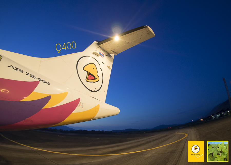
It's time for taking off at 18.45 p.m. by Nok Air flight DD7319 and turbopro Q400. And about an hour, we will say hello to the sky at Bangkok again.
Finally, it also ends our 4 days 3 nights trip, a trip that we'd like to called "go and stop as we wish".
Thank you so much for Khun Noom Photo, who accompanied my journey and used his network in letting us meeting two professional photographers at Chumphon, Khun Tonruk and Khun Pong, who were so kind in taking us around for beautiful angle photography at the beach.
And the Green House Restaurant, who offer us a place to stay cool from the heat with delicious food, let us take a shower and so kind to take us to the airport as well.
And thank you so much to Fresh Coffee at Ranong Bus Terminal for lending us a scooter.
Lastly, I would like to thank Nok Air: สายการบินนกแอร์ for supporting our round trip tickets. See you again at our next block, thank you very much for reading. If you like, please click 'like', if you love it, please share it! Thanks :)
น้ำ-ฟ้า-ป่า-เขา
Tuesday, October 6, 2015 11:16 AM