


"แบกเป้หนึ่งใบไปตามหาน้ำตกรูปหัวใจ ไปพิชิตใจที่ยอดดอยมะม่วงสามหมื่น"
. . . ความจำเจของชีวิตประจำวันทำให้เราตัดสินใจออกเดินทางเพื่อค้นหาสิ่งใหม่ๆ มาเติมพลังให้กับชีวิต ครั้งนี้เราเลือกดอยมะม่วงสามหมื่น-น้ำตกรูปหัวใจเป็นเป้าหมายทริปนี้ถือเป็นทริปเดินป่าหน้าฝนครั้งแรกแน่นอนหลีกเลี่ยงไม่ได้เลยคือต้องเปียก และเละแน่นอน ทริปนี้ถ้าหากใครต้องการไปยอดดอยมะม่วงสามหมื่นและน้ำตกรูปหัวใจ ต้องค้างแรมในป่า 2 คืน แต่ถ้าใครมีเวลาแค่คืนเดียวก็สามารถไปชมน้ำตกรูปหัวใจได้อย่างเดียว
. . . ดอยมะม่วงสามหมื่น-น้ำตกรูปหัวใจ อยู่ในความรับผิดชอบของ หมู่บ้านกุยเลอตอ อ.อุ้มผาง จ.ตาก ระยะทางกว่า 70 กิโลเลตรจากอำเภออุ้มผาง สู่หมู่บ้านกุยเลอตอ พร้อมกับสภาพถนนที่ขรุขระต้องใช้เวลาเกือบ 2 ชั่วโมงเลยทีเดียว
. . . การติดต่อจองลูกหาบ เนื่องจากตัวหมู่บ้านเองไม่มีสัญญาณโทรศัพท์ เราสามารถติดต่อได้เพียงช่องทางเดียวผ่านไลน์เท่านั้น สามารถติดต่อแอดไลน์ไปได้ที่ พี่สุริยา (ผู้ช่วยผู้ใหญ่บ้าน) ที่เบอร์ 088-4299805
. . . แผนการเดินทาง
วันที่ 1 หมูบ้านกุยเลอตอ-จุดตั้งแคมป์ ระยะทางประมาณ 5 กม. ใช้เวลาเดินประมาณ 3 ชั่วโมง
วันที 2 จุดตั้งแค้มป์-ยอดดอยมะม่วงสามหมื่น ระยะทางประมาณ 9.8 กม. ใช้เวลาเดินประมาณ 5 ชั้วโมง และเดินไปน้ำตกรูปหัวใจระยะทางประมาณ 10 กม. ใช้เวลาประมาณ 2 ชั่วโมง และเดินกลับจุดตั้งแค้มป์ 3 กม. ใช้เวลาเดินประมาณ 1 ชั่วโมงครึ่ง
วันที่ 3 จุดตั้งแค้มป์-หมูบ้านกุยเลอตอ ระยะทาง 5 กม. ใช้เวลาเดิน 1 ชั่วโมงครึ่ง
🔥ค่าใช้จ่ายตลอดทริป 3000 บาท/คน (สมาชิกทั้งหมด 10 คน)🔥
. . . บันทึกการเดินทาง วันที่ 26-29 กรกฎาคม 2562
#แสงจันทร์
01 วันแรก
กรุงเทพ - กุยเลอตอ
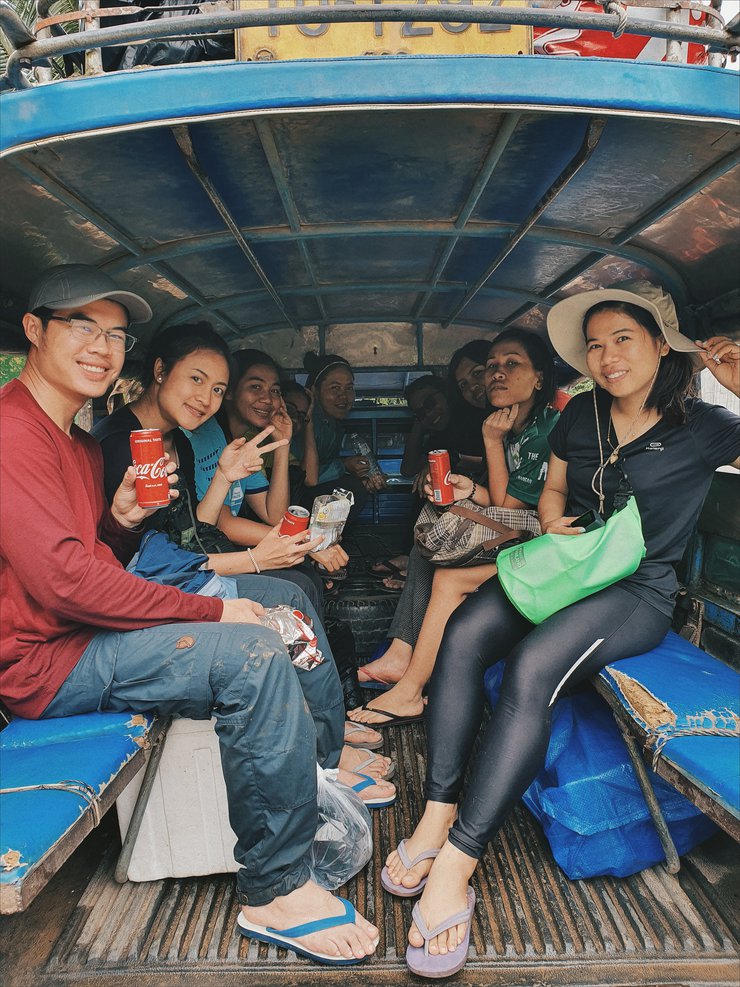
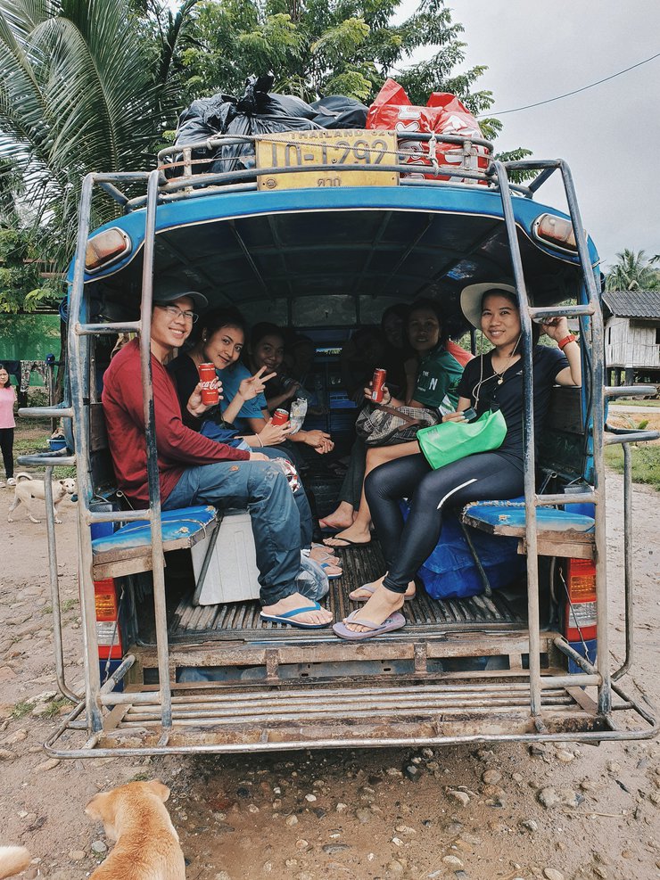
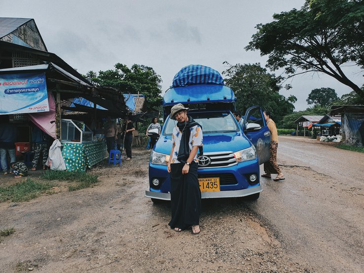
ล้อหมุนจากกรุงเทพมหานครเมืองใหญ่ มุ่งสู้อำเภออุ้มผาง จังหวัดตากจากเวลา 20.00 น. ล้อมาหยุดที่เซเว่นข้างวัดในอำเภออุ้มผางปาเข้าไป 09.00 น.แล้ว นี่เป็นเพียงเป้าหมายแรกของเรา เป้าหมายต่อไปของเราคือ หมู่บ้านกุยเลอตอ ซึ่งห่างจากอุ้มผาง ประมาณ 70 กม. จากการสอบถามสภาพถนนจากพี่สุริยา (ผู้ช่วยผู้ใหญ่บ้านกุยเลอตอ) ได้ความว่า เราสามารถนั่งรถตู้เข้าไปถึงตัวหมู่บ้านได้เลย เราก็มั่นใจกันเต็มที่หลังจากกินข้าวเตรียมสัมภาระเสร็จก็มุ่งสู่จุดหมายต่อไปเลย
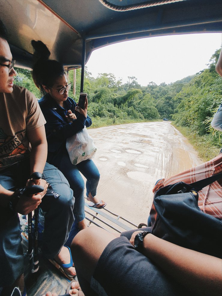
รถตู้วิ่งมาได้สักสิบกิโล ถนนเริ่มไม่ราบเรียบอย่างที่คิดกัน หลุ่มบ่อเริ่มปรากฎให้เห็น และเริ่มเยอะขึ้นเรื่อยๆเมื่อระยะทางไกลขึ้น จนกระทั่งขับมาได้ประมาณยิบกว่ากิโลเมตร พวกเราก็ต้องยอมแพ้กับสภาพถนน ที่ขรุขระมากๆเกินกว่าคนขับรถจะหักหลบได้หมด พวกเราเลยตัดสินใจโบกรถโดยสารกลางทางกันไปเราเริ่มต้นเดินทางกับรถโดยสารที่บ้านแม่จัน อีกไม่ถึงสามสิบกิโลเมตรต่อจากนี้เราก็จะถึงจุดหมาย


รถโดยสาร อุ้มผาง-เปิงเคลิ่ง มาส่งเราที่จุดเริ่มเดิน
ซึ่งเลยหมู่บ้านกุยเลอตอมาประมาณ 200 เมตรเมื่อเวลา 12.00 น.
เพื่อไม่เป็นการเสียเวลาซึ่งเรามาสายมากแล้วก็รีบขนของลง
และแบ่งของให้ลูกหาบที่ทำการจองไว้ล่วงหน้า และลงทะเบียนกัน
(ค่าลงทะเบียนคนละ 20 บาท) ก่อนเริ้มเดิน

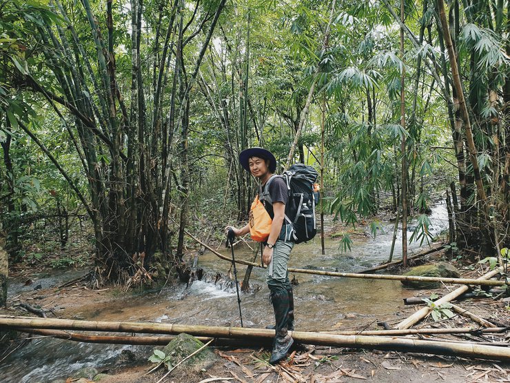
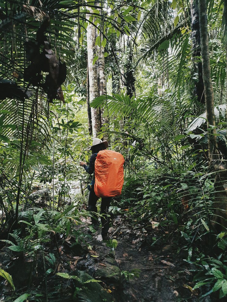
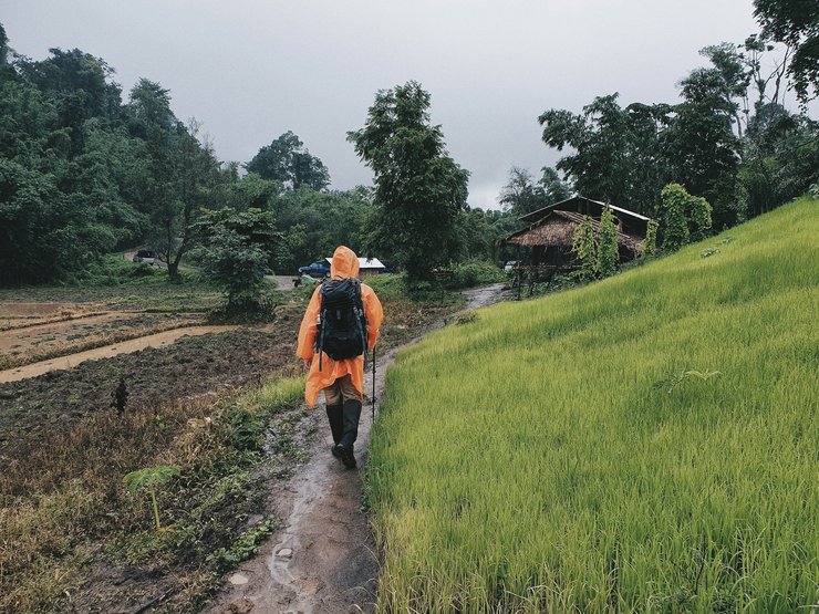
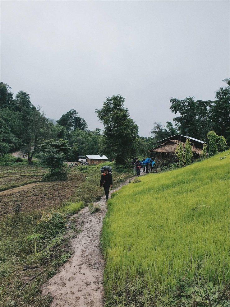
ระยะทางจากจุดเริ่มเดินไปยังจุดตั้งแค้มป์ประมาณ 5 กิโลเมตร
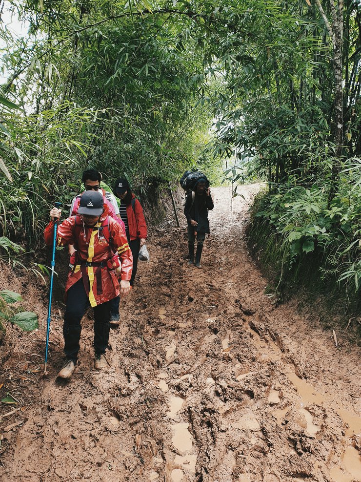
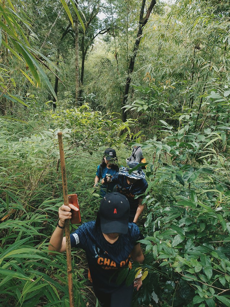
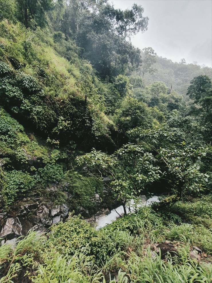
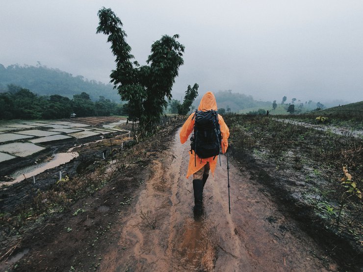
สภาพการเดินช่วงแรกเราจะผ่านไร่นาของชาวบ้านไปก่อน ทางเดินค่อนข้างเละ
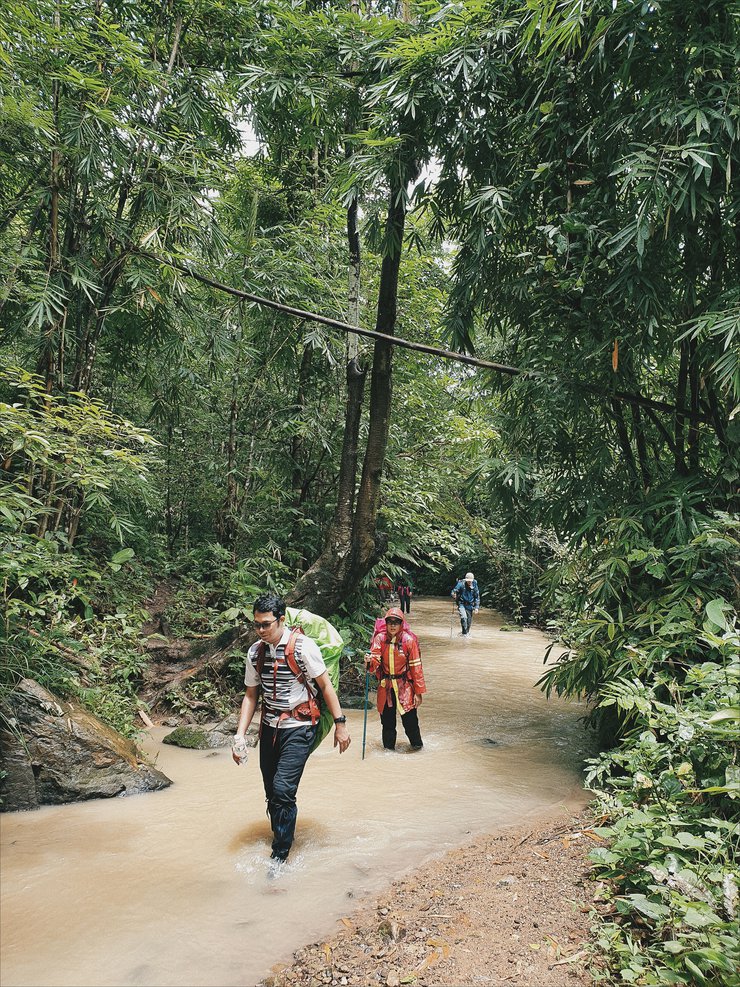
สลับกับเดินตามทางน้ำไป

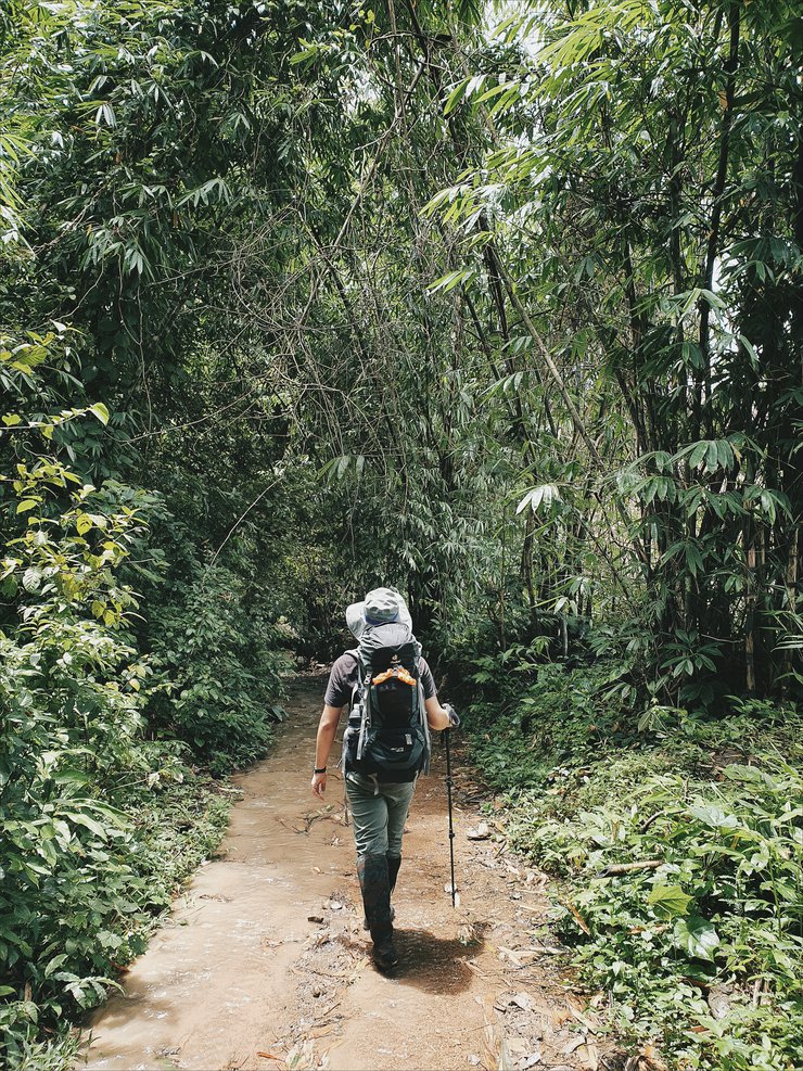
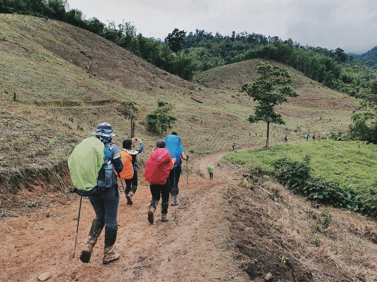
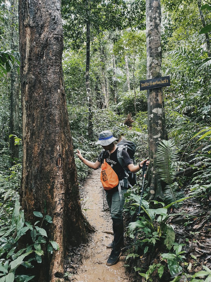
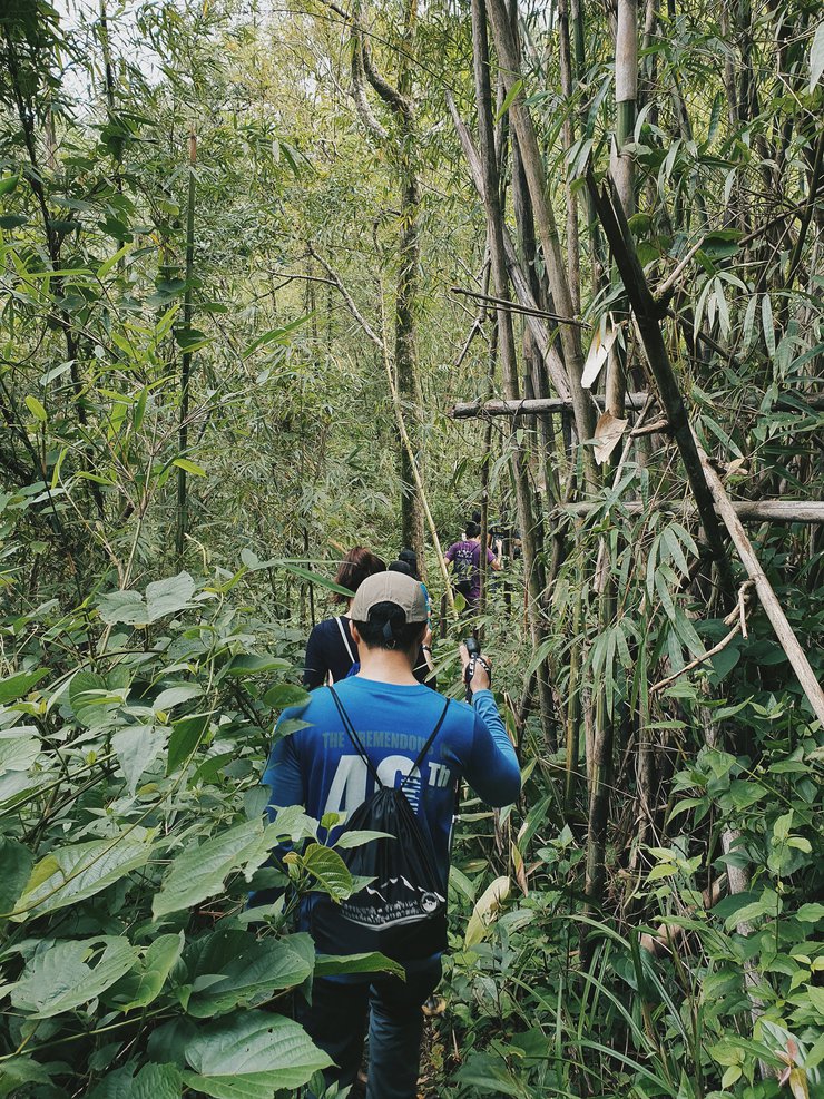
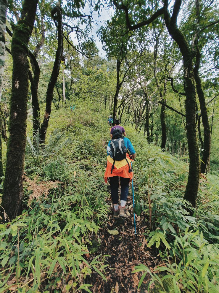
ช่วงที่สองของการเดินเราจะต้องเดินเข้าป่ากัน
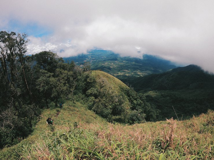
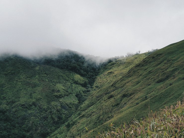
ป่าช่วงนี้ค่อนข้างอุดมสมบูรณ์เพราะเป็นหน้าฝน ใบไม้เขียวชอุ่ม
ลำธารได้ข้างมีเสียงน้ำไหลตลอดเวลา
ช่วงนี้เราจะได้ออกแรงกันเนินขึ้นเขากันเล็กน้อย
ใช้เวลาจากจุดเริ่มเดินถึงจุดตั้งแคมป์ประมาณ 5 ชั่วโมง
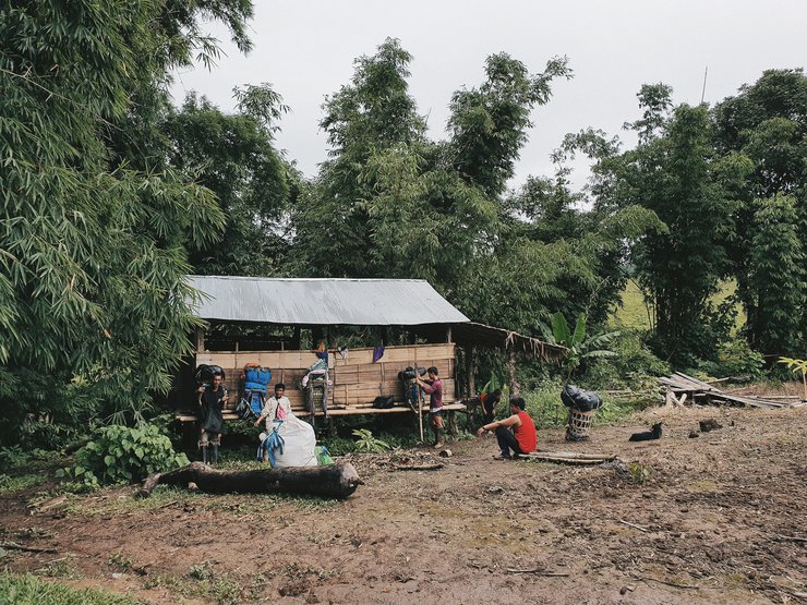
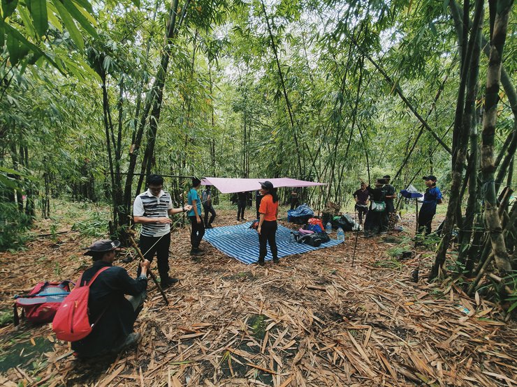
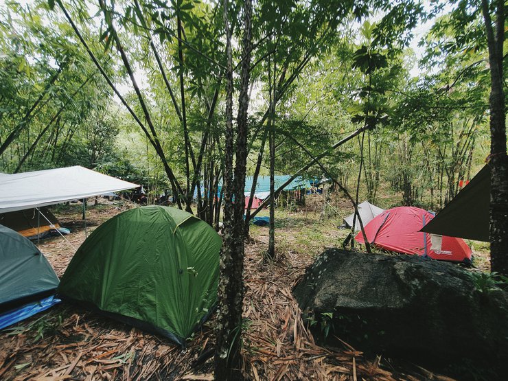
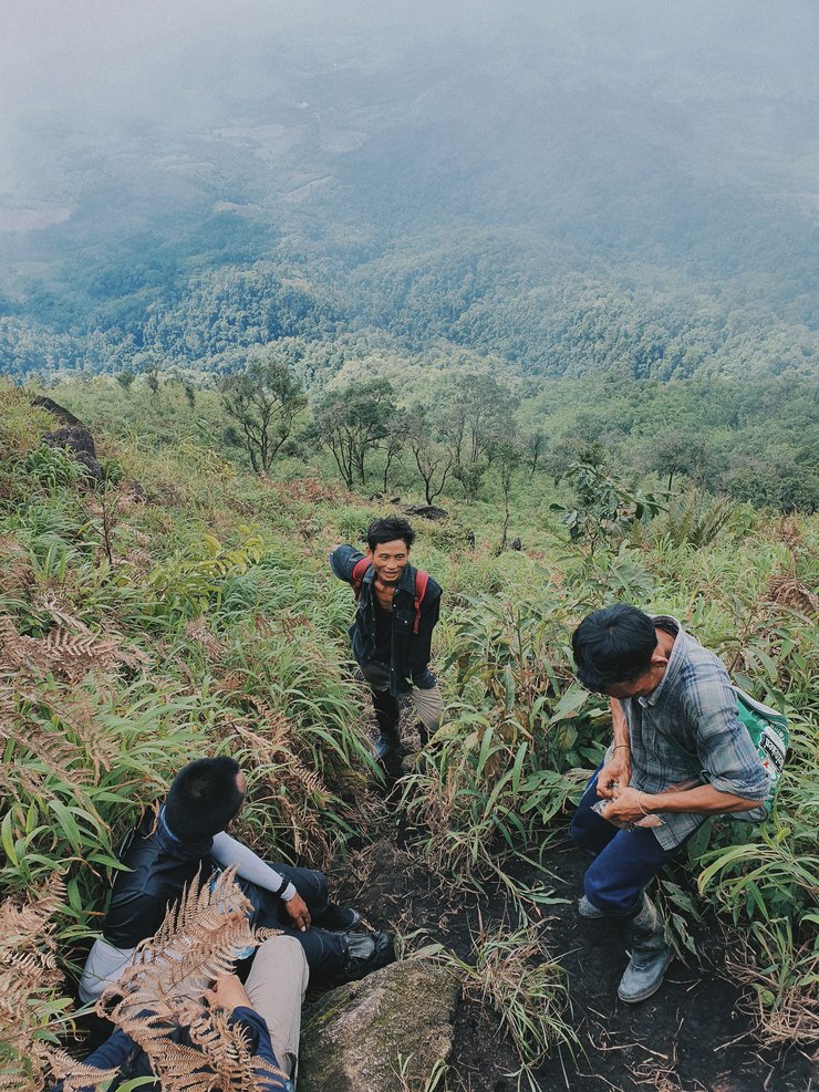
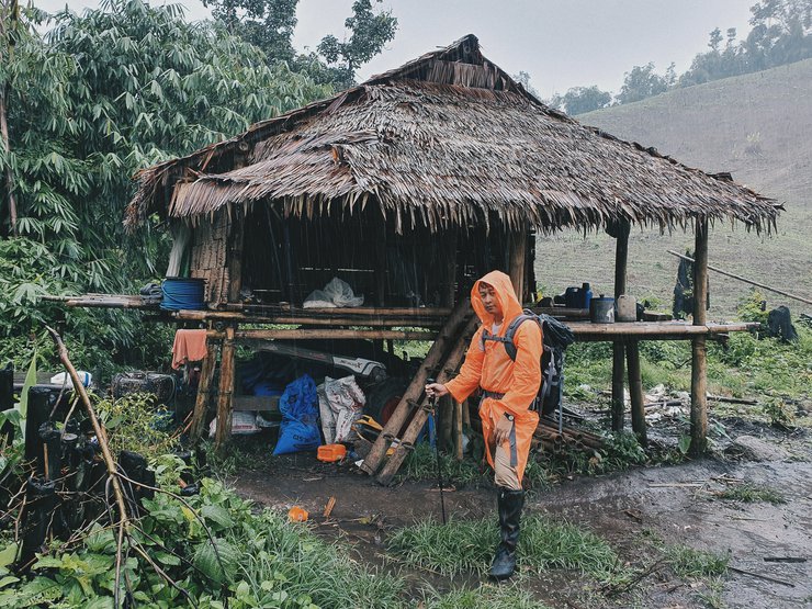
มาถึงเราก็ทำการกางเต็นท์ ช่วงนี้เป็นช่วงที่นักเดืนป่ามาที่นี่กันเยอะมาก
กลุ่มของเราลูกหาบช่วยจองพื้นที่ไว้ให้แล้วมาถึงก็เริ่มกางเต็นท์กันได้เลย
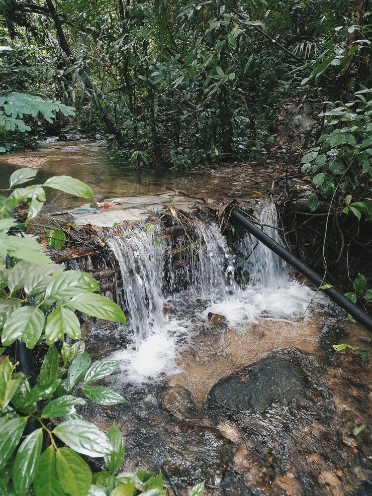
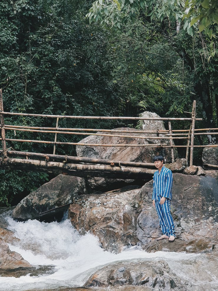
บริเวณจึดกางเต็นท์จะมีส้วทหลุมไว้ให้ และข้างๆมีธารน้ำ
เราสามารถอาบน้ำได้ที่นี่เลย
02 วันที่สอง
จุดตั้งแคมป์-ยอดดอยมะม่วงสามหมื่น-น้ำตกรูปหัวใจ
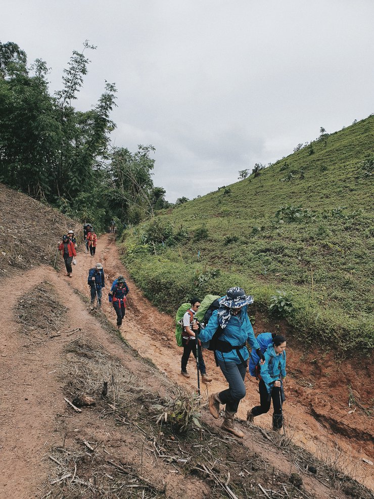
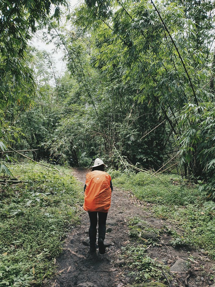
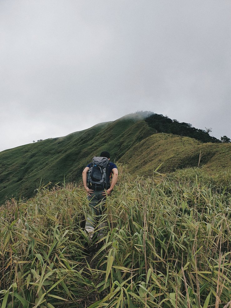
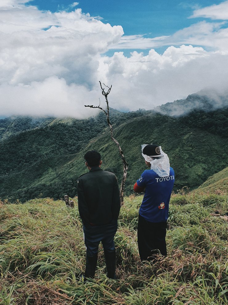
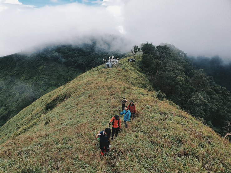
เวลา 07.30 น. หลังจากรับประทานอาหารเช้าเสร็จเราก็เริ่มออกเดินทางกันเพราะวันนี้เราต้องเดินทางกันค่อนข้างไกล จุดหมายแรกที่เราตั้งเป้าไว้ก็คือยอดดอยมะม่วงสามหมื่น ซึ่งอยู่ห่างจากจุดตั้งแค้มป์ประมาณ 9.8กิโลเมตรซึ่งถือว่าค่อนข้างไกลเลยทีเดียวสำหรับการเดินบนเขา
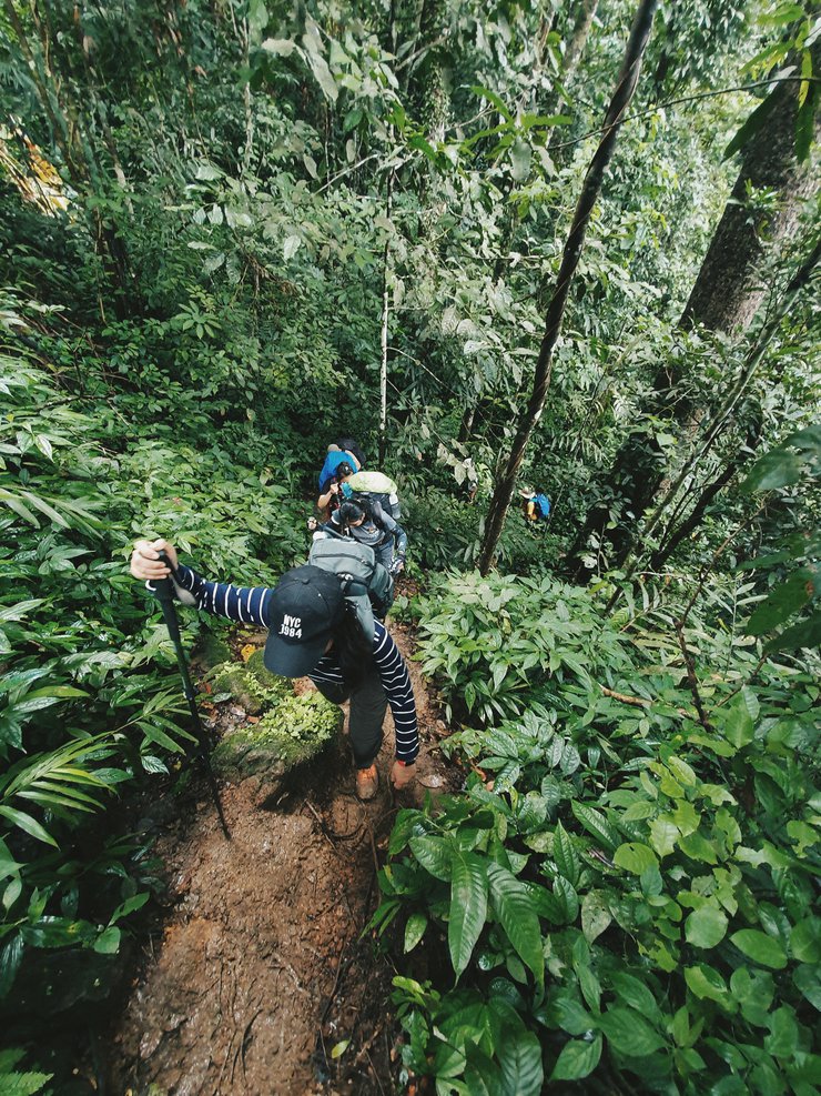
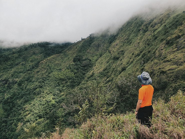
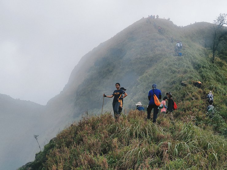
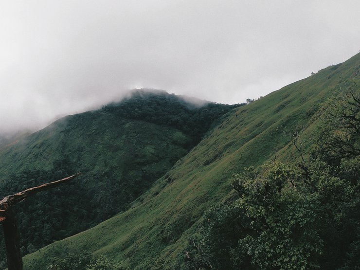
ช่วงแรกของการเดินค่อนข้างชัน และป่าค่อนข้างรกทึบหญ้าชูยอดสูเฉียดเอวขณะเดินผ่านปราศจากซึ่งลม อากาศตอนเช้าที่แสนสะบายหายไปพร้อมกับเหงื่อที่คอยผุดออกมาตลอดเวลาที่ก้าวเดินไป เราต้องค่อยๆหยุดพักเหนื่อยเป็นระยะๆเพื่อให้ร่างกายปรับตัวก่อน
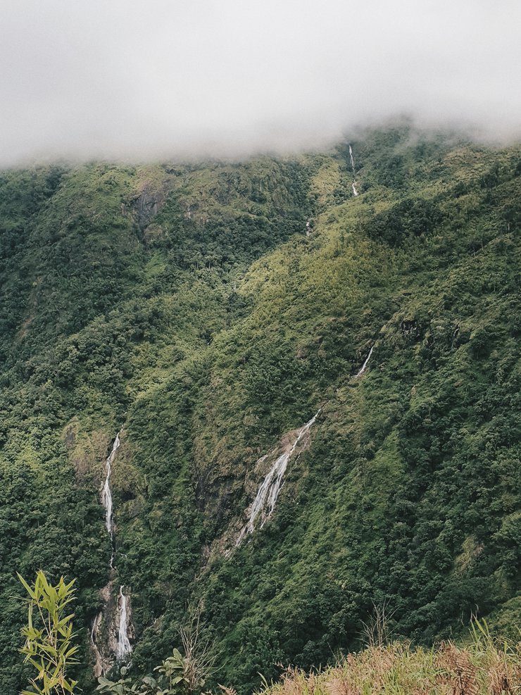
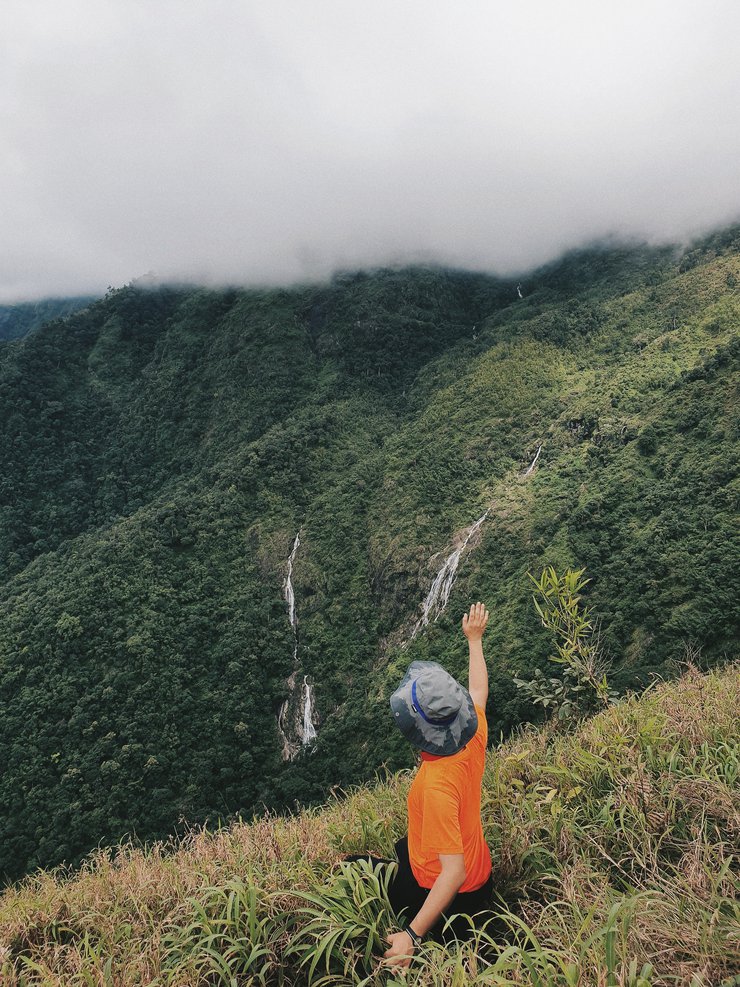
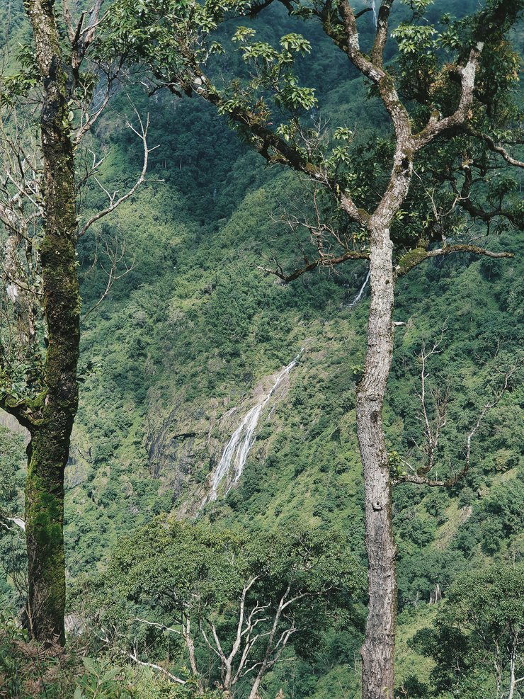
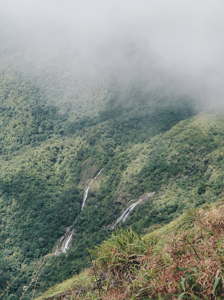
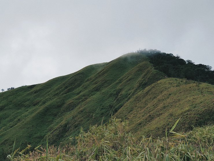
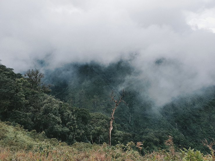
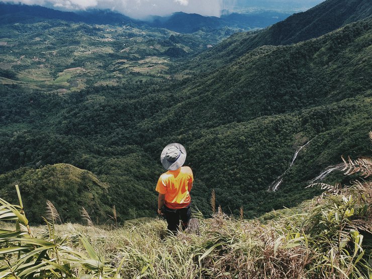
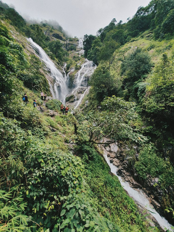
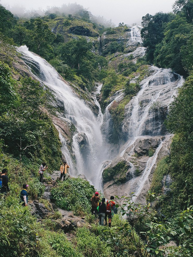
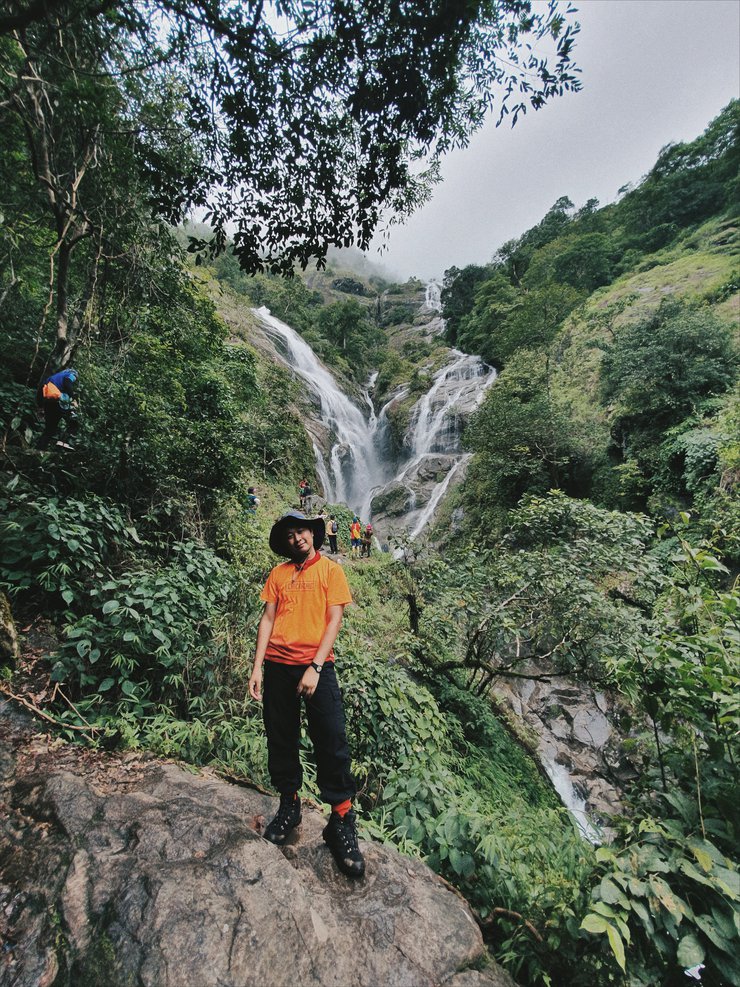
2 ชั่วโมงผ่านไป เราก็มาถึงจุดพักหรือจุดชมวิวแรก ตรงจุดนี้เราจะมองเห็นวิวหุบเขาที่มีสายน้ำสองสายไหลตกลงมาจากยอดดอยมะม่วงสามหมื่น

พักเหนื่อยชื่นชมบรรยากาศ และเก็บภาพเสร็จเราก็รีบออกเดินทางต่อ
เพราะนี่ยังไม่ถึงครึ่งทางเลย
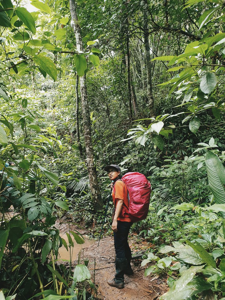
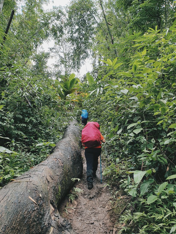
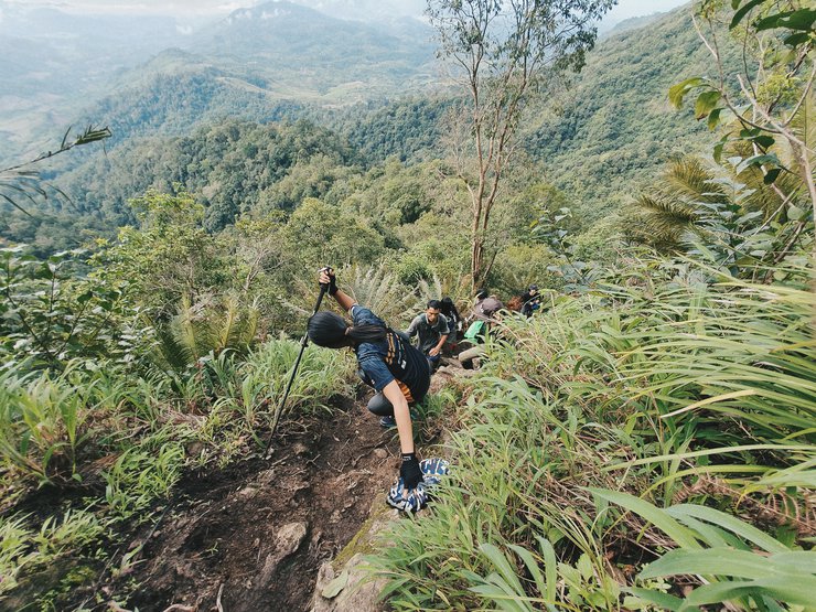
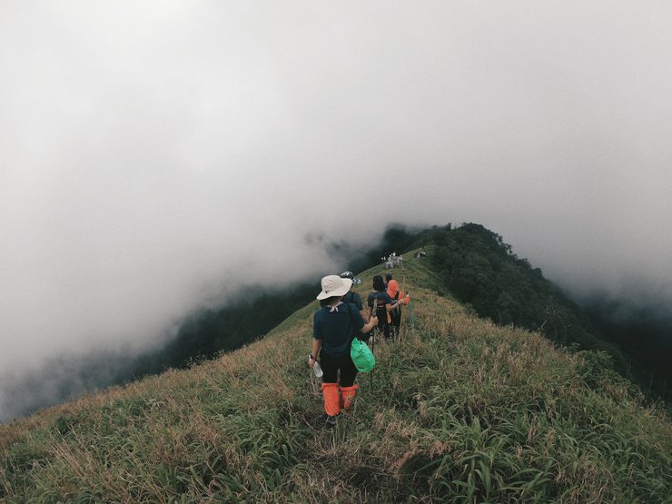
สภาพการเดินช่วงถัดมาค่อนข้างเหนื่อยมากกว่าช่วงแรก
เพราะทางที่เริ่มชันมากขึ้น เราก็เดินได้ช้าลงเพราะหนื่อยง่ายกว่าเดิม


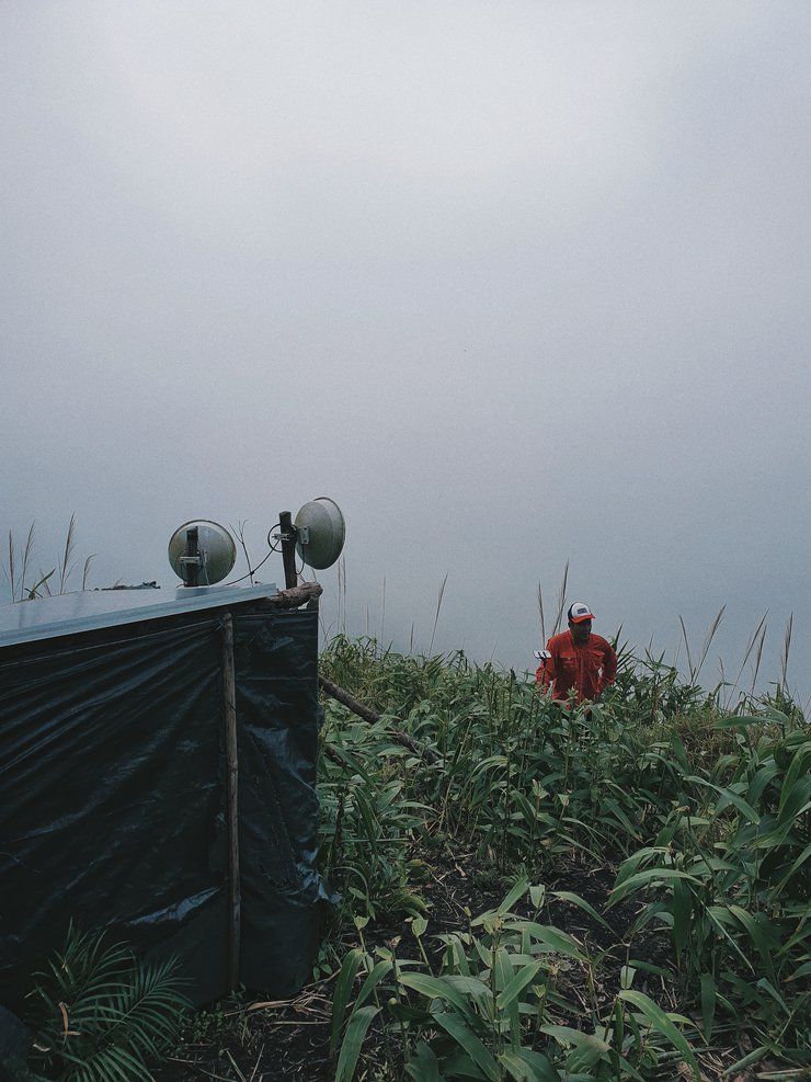
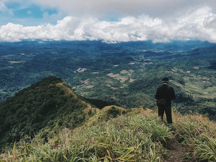
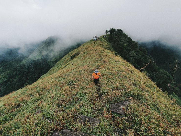
เวลา 11.30 น. เราก็มาถึงครึ่งทางหรือยอด หมื่นห้า ตรงจึดนี้ถือเป็นจุดตั้งต้นสำหรับเดินไปยอดดอยมะม่วงสามหมื่นเสียงเตือนจากแอพต่างๆในโทรศัพท์ดังขึ้นเนื่องจากจึดนี้เป็นจุดรับสัญญาณโทรศัพท์ พวกเราต่างยกมือถือกันขึ้นมาเพื่อเช็คอินทางออนไลน์ เพราะเกือบ 24 ชม.ที่เราออฟไลน์ไป
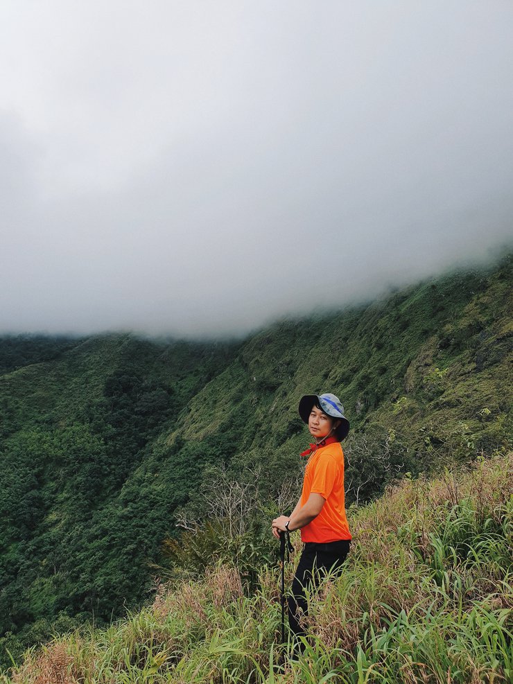
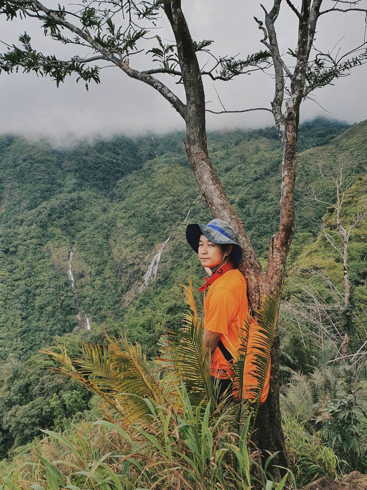
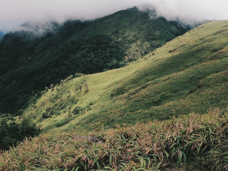
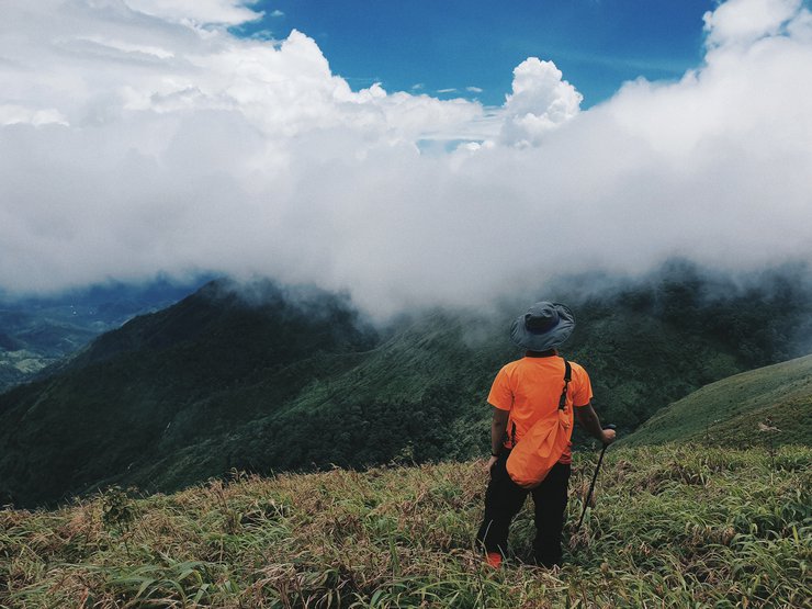
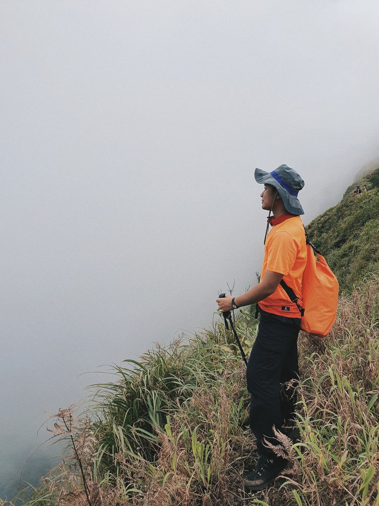
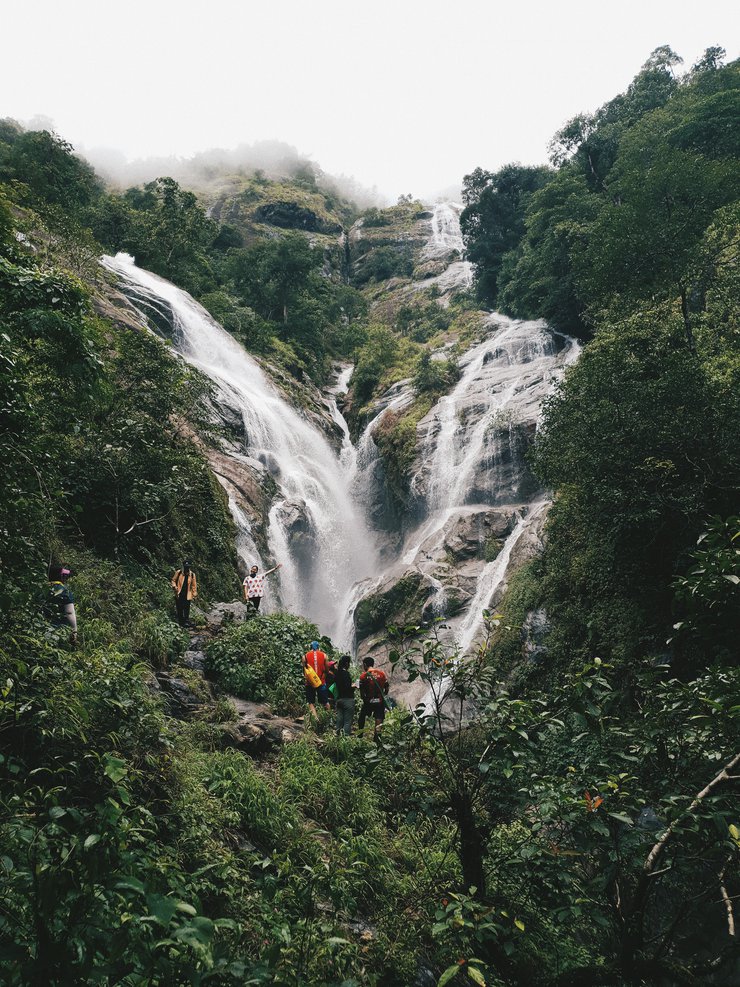
ตรงจุดนี้เราเริ่มมองเห็นน้ำตกสองสายชัดเจนมากขึ้นเมฆฝนที่ลอยต่ำทะยอยไหลเข้าออกหุบเขาด้านหน้าเราเป็นระยะๆ ให้นักท่องเที่ยวได้สัมผัสไอเย็นของเมฆฝนและลมที่คอยพัดแรงก็ช่วยคลายความร้อนจากการเดินได้เป็นอย่างดี


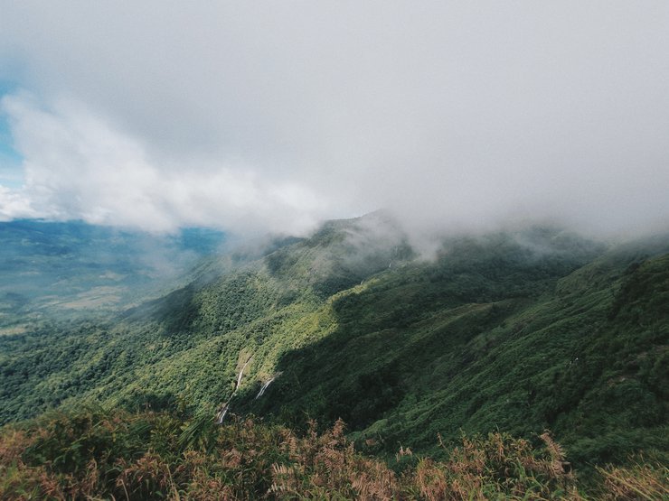
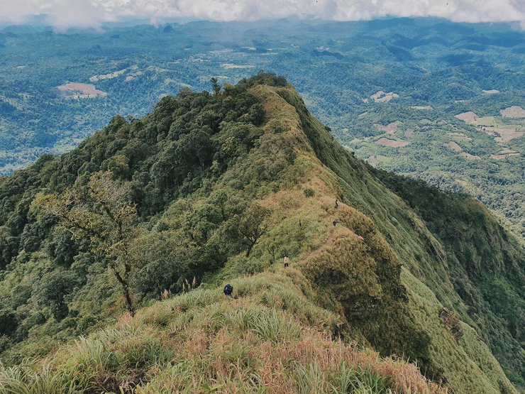
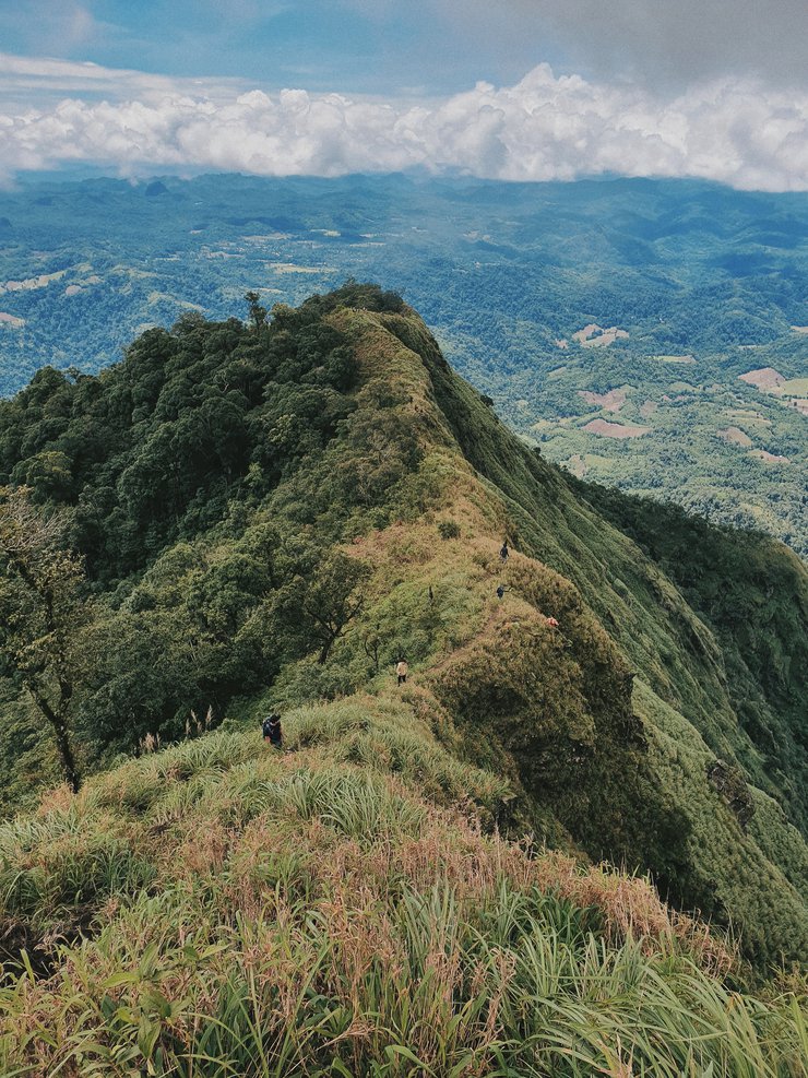
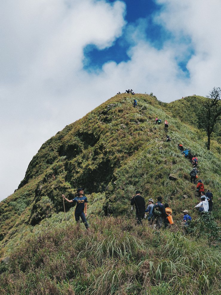
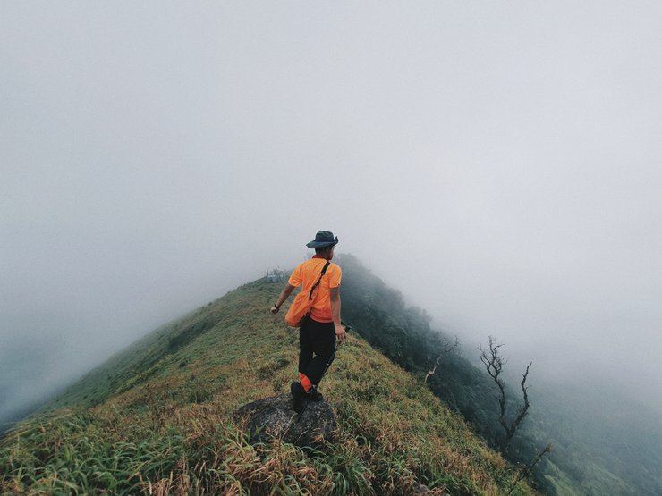
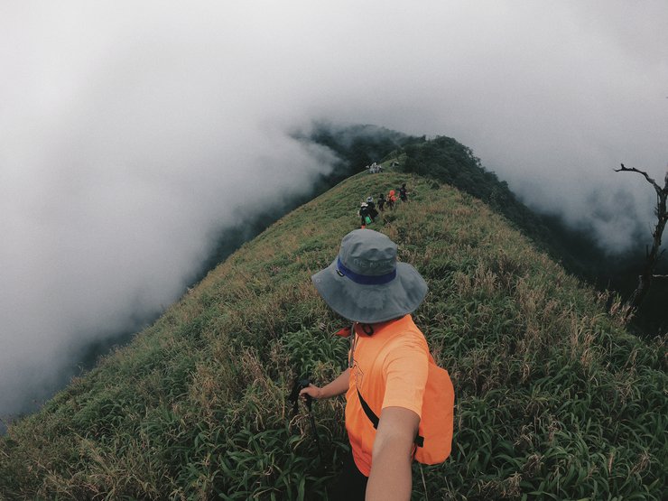
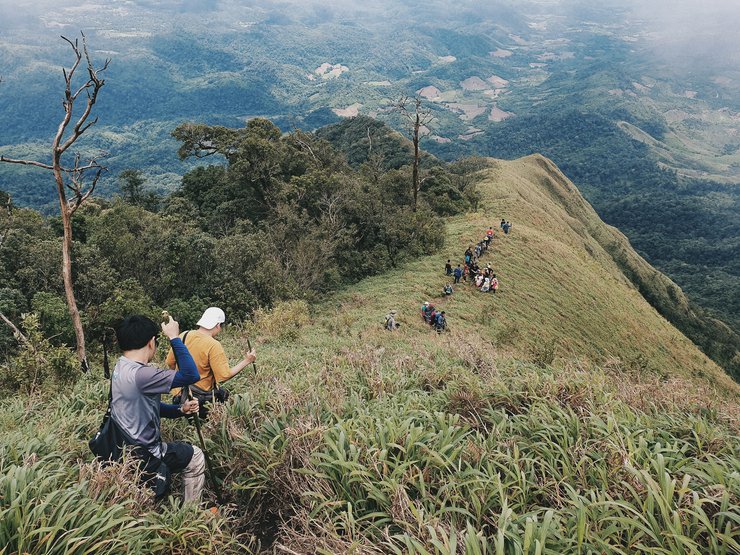
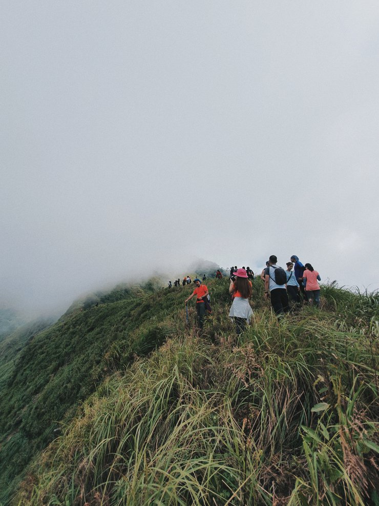
เราพักเหนื่อยกันสักพักก็ตัดสินใจออกเดินต่อเพราะระยะอีกค่อนข้างไกลกว่าจะถึงยอดการเดินช่วงนี้เป็นการเดินตามสันเขาที่เป็นเนินสูงต่ำ ไต่ระดับขึ้นไปเรื่อยอากาศร้อนสลับกับเย็นสะบายเนื่องจากเมฆฝนที่คอยพัดมาแล้วก็หายไปเป็นครั้งคราวตลอดกานเดินทาง
ทางเดินค่อนข้างชันทำให้เราเดินทำเวลาไม่ค่อยได้เท่าไหร่อีกทั้งเพราะความสวยงามระหว่างเดินทำให้เราอดใจไม่ได้ที่จะแวะถ่ายรูปเก็บภาพบรรยากาศเป็นระยะตลอดทาง

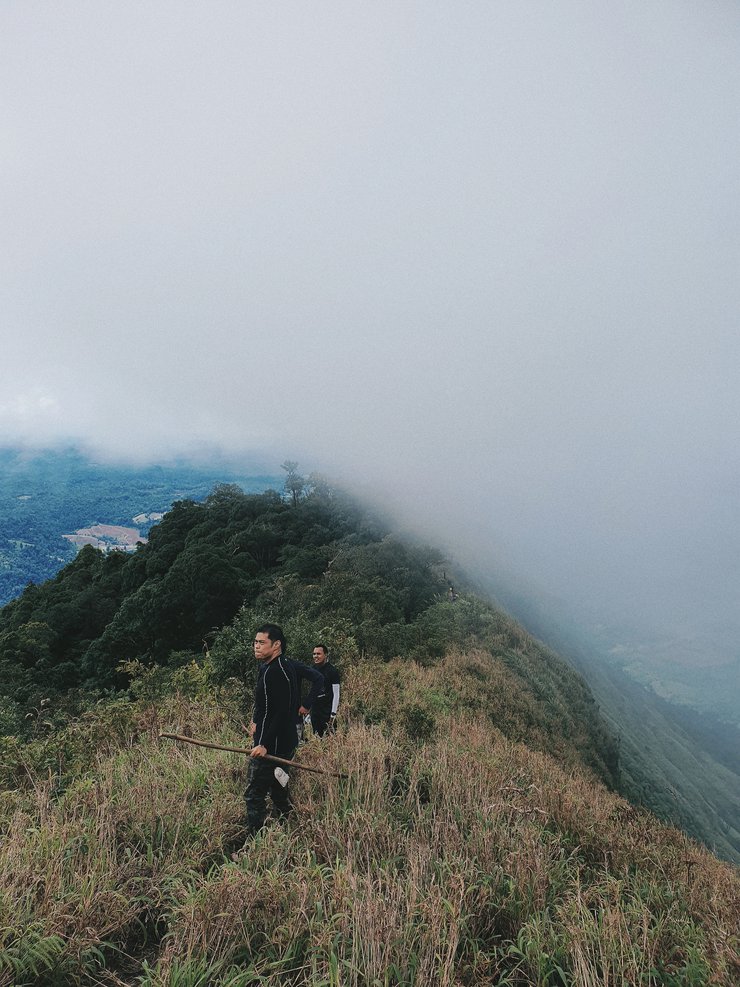
เดินมาได้สักพัก
วิวสองข้างทางเริ่มเปลี่ยนไปเนื่องจากระดับความสูงที่เพิ่มขึ้น
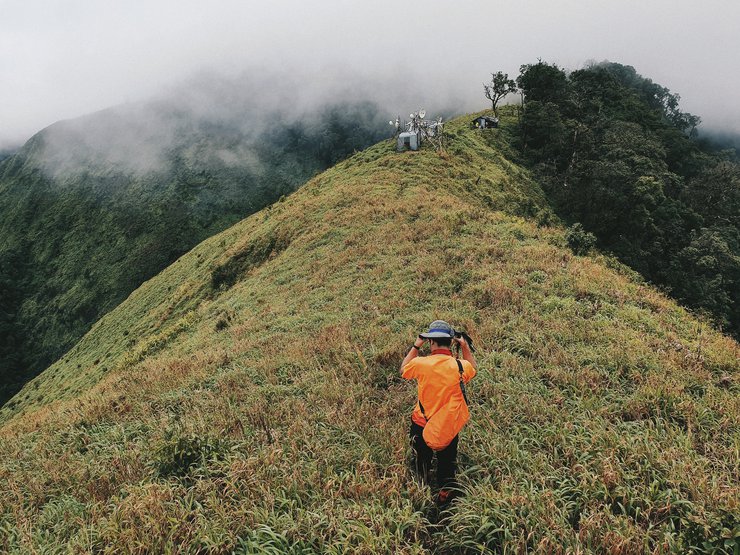
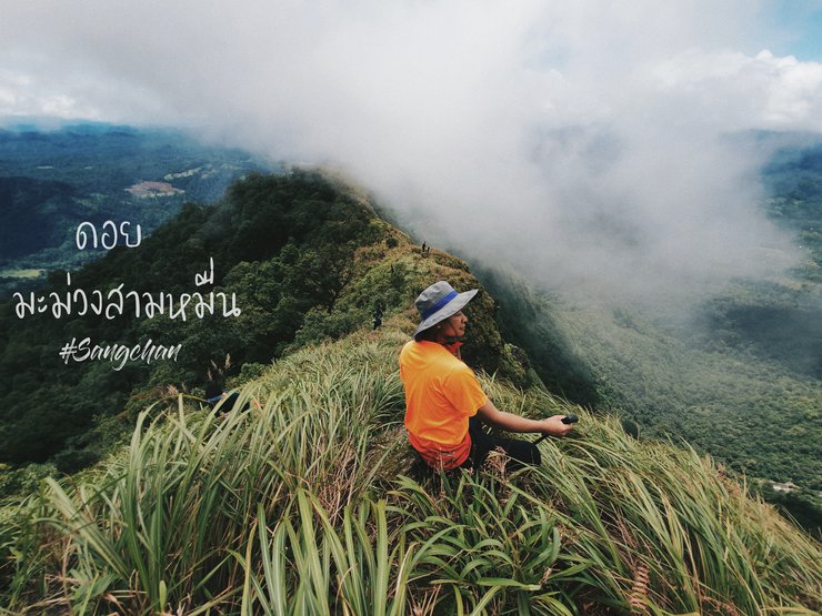
ยอดดอยมะม่วงสามหมื่นเริ่มปรากฎในสายตา
ทำให้มีกำลังใจในการเดินต่อไปมากขึ้น
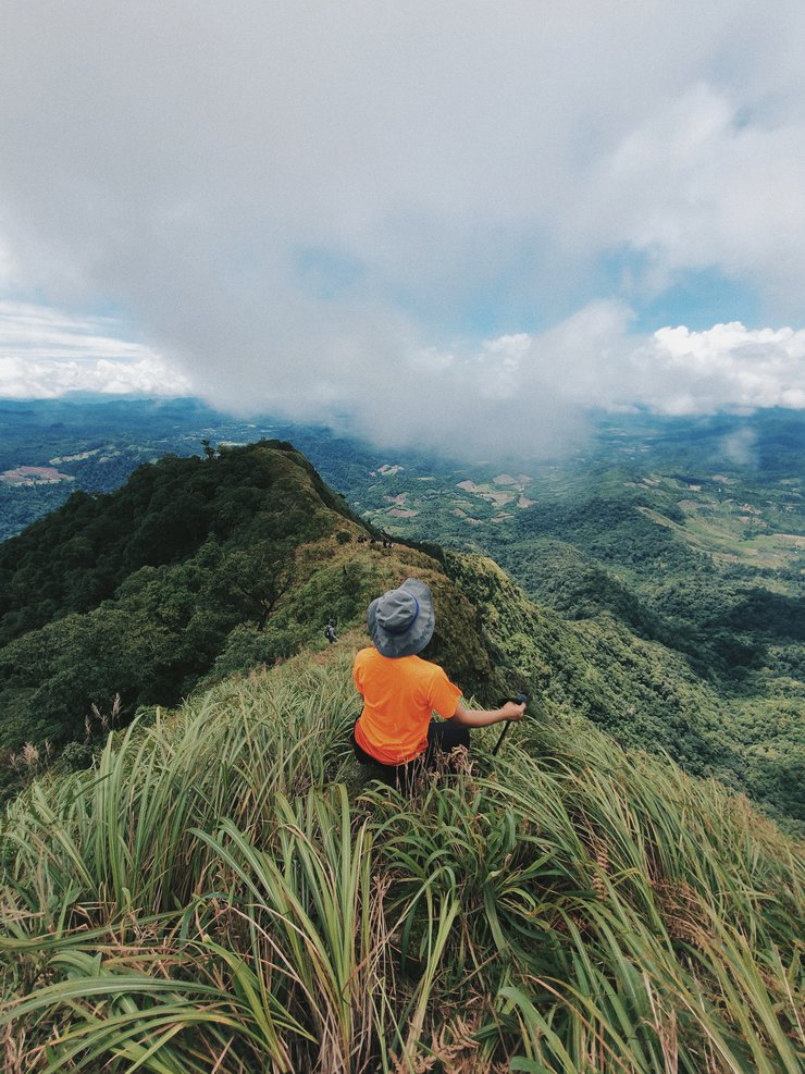
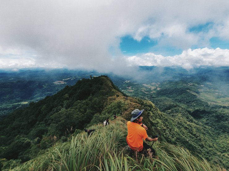
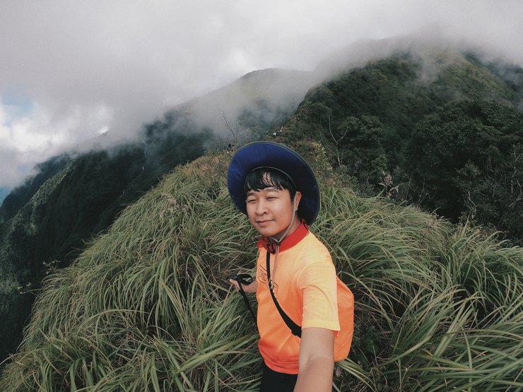
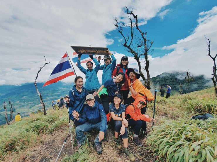
ยอดดอยมะม่วงสามหมื่น
13.00 น. ในที่สุดเราก็มาถึงยอดดอยม่วงสามหมื่นเป็นเนินเขาเล็กๆที่เต็มไปด้วยนักท่องเที่ยวกลุ่มอื่นเราจึงเดินต่อไปอีกเล็กน้อยที่เสาเรดาจุดรับสัญญาณเพื่อพักทานอาหารกลางวันกัน เพราะเลยดวลาเที่ยงมาสักพักแล้ว
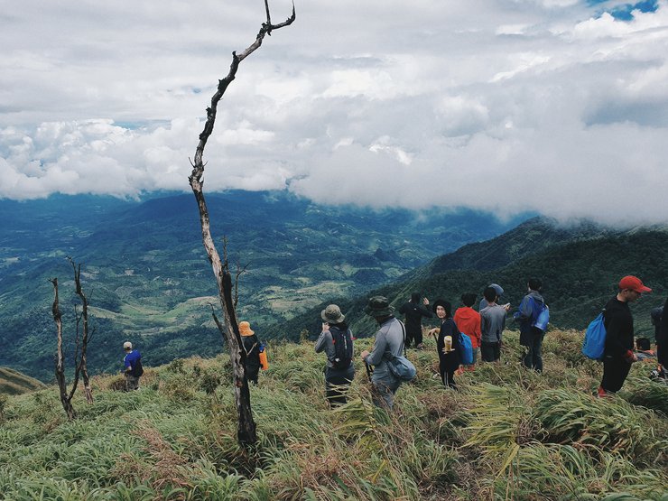
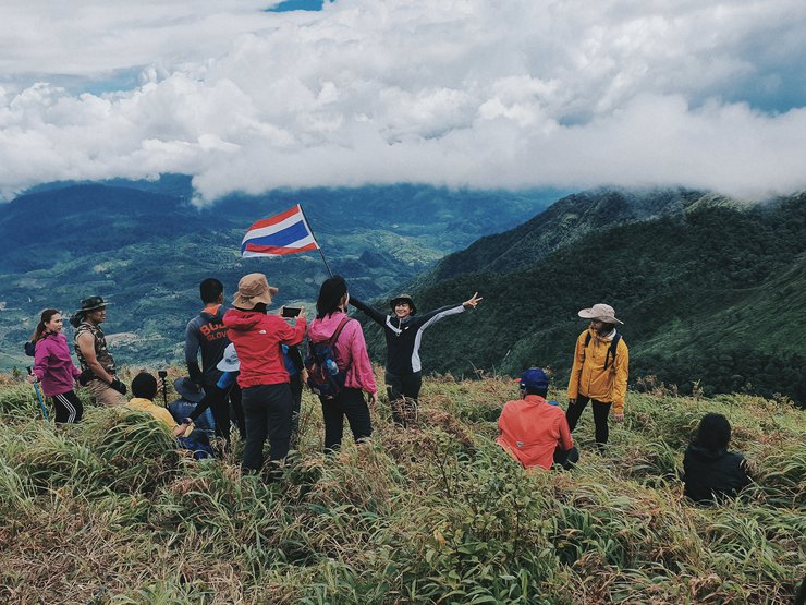

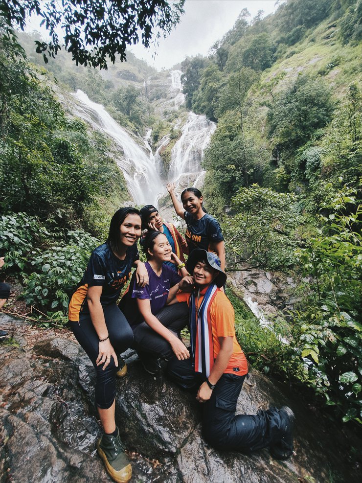
เราใช้เวลาทานข้าวกันไม่นาน ก็เดินกลับขึ้นไปที่ยอดดอยมะม่วงสามหมื่นเพื่อถ่ายรูปหมู่ และเตรียมตัวเดินกลับ เพื่อไปยังน้ำตกรูปหัวใจ

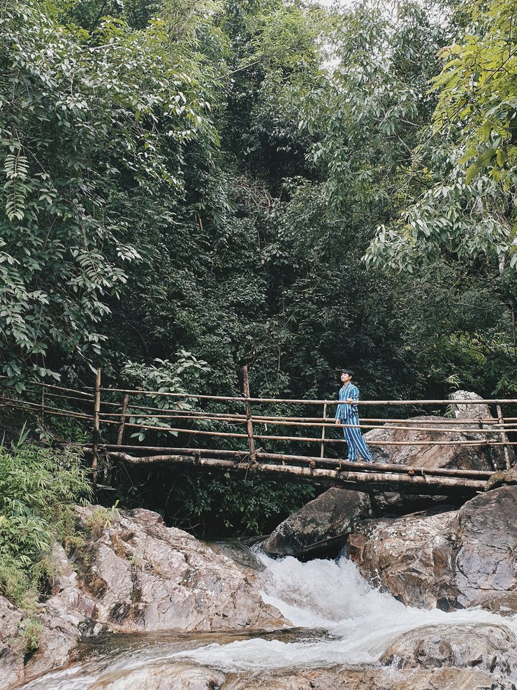
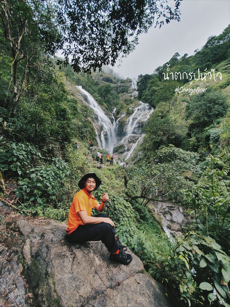
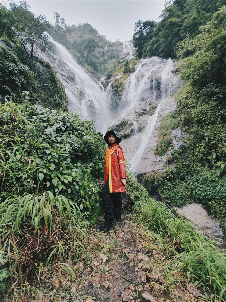
น้ำตกรูปหัวใจ
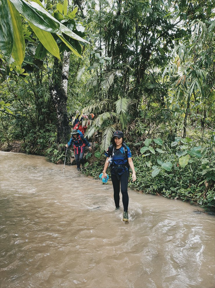
จากยอดดอยมะม่วงสามหมื่น ย้อนกลับลงมาทางเดิมระยะทางถึงน้ำตกรูปหัวใจประมาณ 10 กม. เราใช้เวลาเดินลงประมาณ 2ชั่วโมงก็ลงมาถึงน้ำตก บริเวณน้ำตกสามารถเล่นน้ำได้ด้านล่างส่วนด้านบนเป็นหน้าผาไม่สามารถเล่นน้ำไ
เวลาประมาณ 16.00 น. เราก็เดินลงจากน้ำตกเพื่อจะไปยังจุดตั้งแค้มป์กัน
ใช่เวลาเดินประมาณ 2 ชั่วโมงก็มาถึง วันนี้เราเดินกันหนักมาก
ระยะทางไปกลับเกือบ 20 กม.
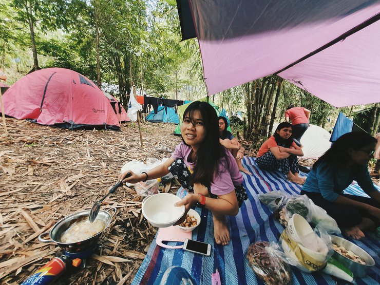
เราก็มาอาบน้ำล้างตัวกันที่ธารน้ำข้างที่ตั้งแค้มป์
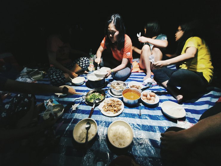
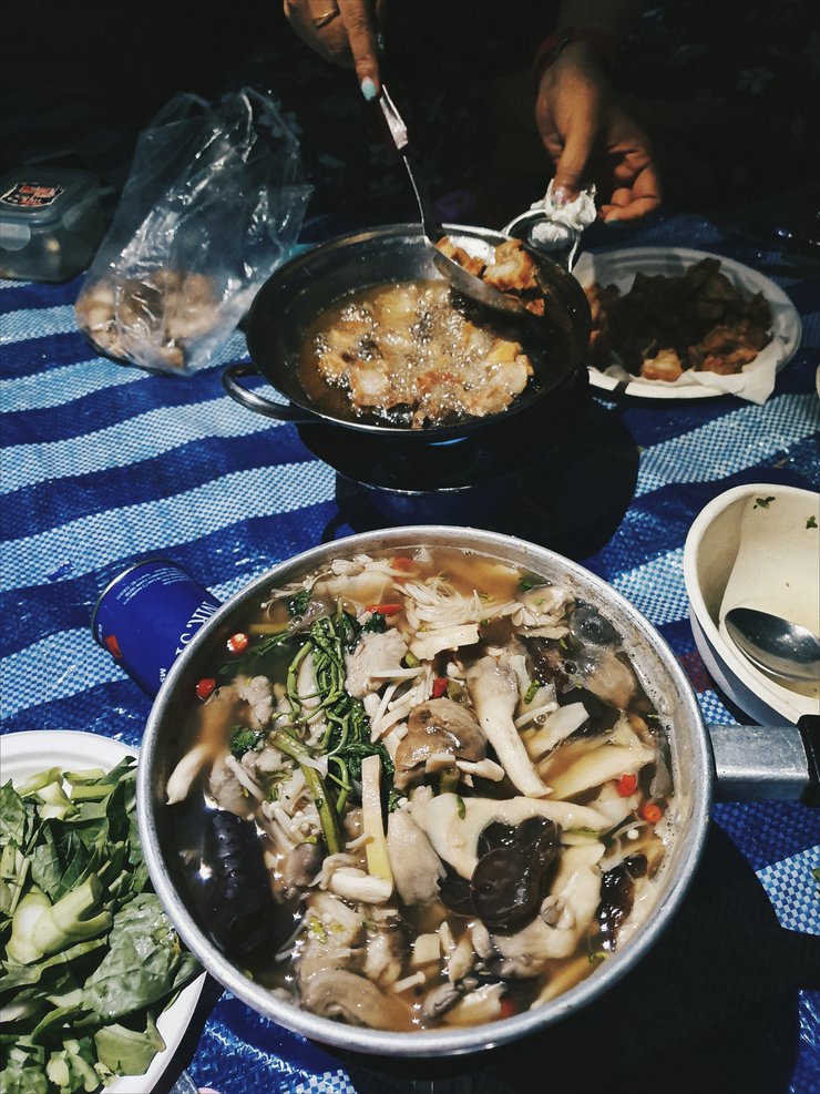
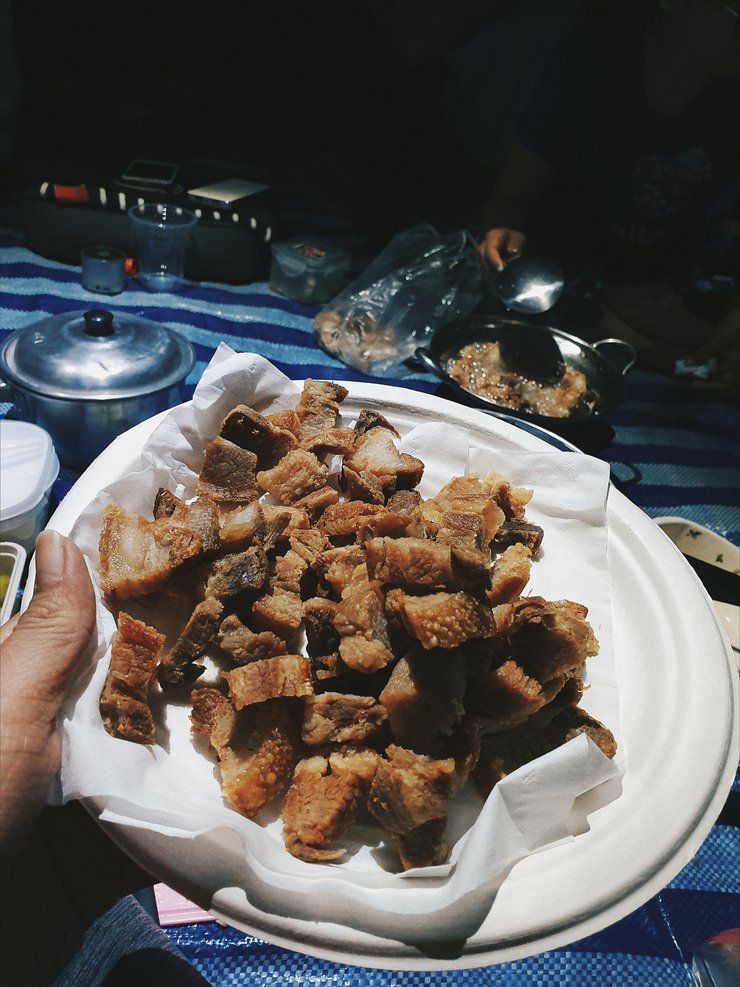
คืนนี้เราช่วยกันทำอาหาร หลังจากทานข้าวเสร็จทุกคนก็เข้าที่พัก
เพื่อผักผ่อนก่อนกลับในพรุ่งนี้เช้า
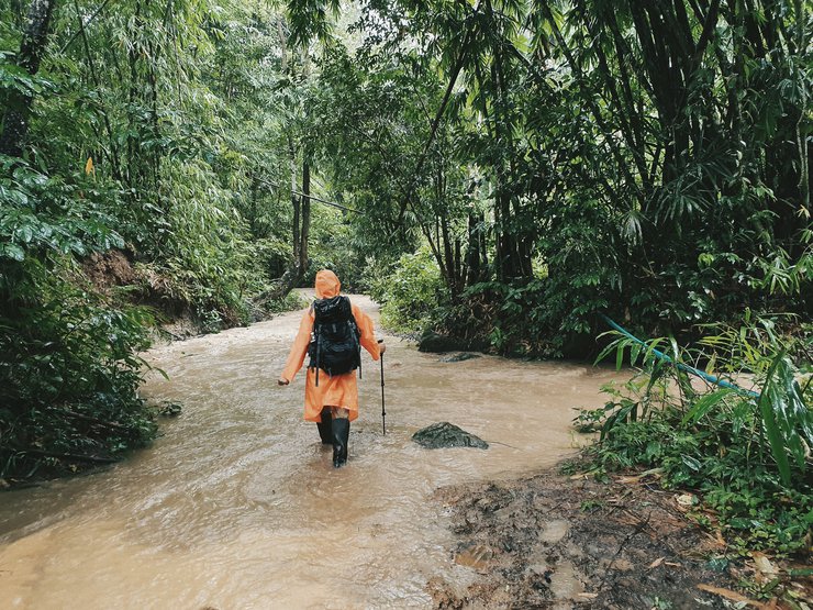
เช้าวันรุ่งขึ้นเราตื่นขึ้นมาพร้อมกับเสียงฝนตกลงมากระทบกับผ้าใบเต็นท์
ทุกคนต่างลุกขึ้นมาเตรียมความพร้อมเก็บของเก็บเต็นท์เพื่อเดินทางกลับ เวลา
07.30 น. เราก็เริ่มเดินลงกันพร้อมกับสานฝนที่ตกลงมาอย่าต่อเนื่อง
กลุ่มเราลงมาถึงด้านลงเป็นกลุ่มแรกๆของวัน
พักผ่อนเปลี่ยนเสื้อผ้ากันเรียบร้อยก็นั่งรถต่อเข้าไปยังอุ้มผาง
เพื่อเดินทางกลับกรุงเทพกัน
. . . สุดท้ายนี้อยากขอบคุณพี่สุริยันและทีมงานลูกหาบทั้งสี่คนที่ช่วยเหลือพวกเราทุกอย่างให้ทริปนี้สำเร็จและราบรื่นตลอดทั้งทริป

. . . จนกว่าจะพบกันใหม่ . . .
#แสงจันทร์


แสงจันทร์
วันอังคารที่ 6 สิงหาคม พ.ศ. 2562 เวลา 15.02 น.